- Usage in publication:
-
- Rangeley Formation*
- Modifications:
-
- Revised
- Areal extent
- AAPG geologic province:
-
- New England province
Summary:
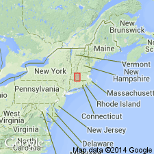
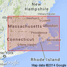
Footnotes [added to report just before it went to press] indicate that parts of the Littleton and Partridge Formations, and Clough Quartzite in MA are here assigned to the Rangeley Formation [here geographically extended to MA]. Littleton Formation rocks in the belt that enters MA from NH east of the Keene gneiss dome and extending to southwest of Ware, and rocks in the Amherst inlet where Littleton and Partridge Formation are complexly interfolded, are here assigned to the Rangeley Formation. The four mapped areas of Clough Quartzite in the Amherst area west of the Connecticut Valley border fault are now interpreted as conglomerate lenses in the Rangeley. [These changes are not reflected on the MA State bedrock geologic map of Zen and others (1983).] [Papers presented as chapters in U.S. Geological Survey Professional Paper 1366 are intended as explanations and (or) revisions to MA State bedrock geologic map of Zen and others (1983) at scale of 1:250,000.]
Source: GNU records (USGS DDS-6; Reston GNULEX).
- Usage in publication:
-
- Rangeley Formation*
- Modifications:
-
- Age modified
- AAPG geologic province:
-
- New England province
Summary:
Of Llandovery and possible Llandovery age (brachiopods), but may range into earliest Wenlock. Underlying Greenvale Cove Formation is early Llandovery(?).
Source: GNU records (USGS DDS-6; Reston GNULEX).
- Usage in publication:
-
- Rangeley Formation*
- Modifications:
-
- Revised
- Areal extent
- AAPG geologic province:
-
- New England province
Summary:
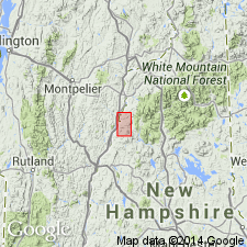
Stratigraphy differs radically from that of Hadley (1942, 1950), White and Billings (1952), in Mt. Cube and Woodsville 15-min quads, respectively, and revisions of Rumble (1942) east of Connecticut River. Fundamental difference is that Moench recognizes seven formations (plus members) that constitute Piermont allochthon. Hadley (1942) mapped all of these as Albee Formation, a name not used in this report. Rocks previously mapped as Albee are reassigned to stratigraphic equivalents of Quimby (Upper Ordovician?), Greenvale Cove (Lower Silurian), Rangeley (Lower Silurian), Perry Mountain (Silurian), Smalls Falls (Upper Silurian), Madrid (Upper Silurian?), and Littleton (Lower Devonian) Formations, whose type localities, except for Littleton, are near Rangeley, ME (Moench and Boudette, 1987). Rangeley of the allochthon is thinner than type Rangeley (1000 m vs. 3000 m, respectively). Conglomeratic members A and C of type Rangeley are clearly mappable. Piermont Member of Albee Formation of Hadley (1942) approximately corresponds to Rangeley. Like member C of type Rangeley, upper part of Rangeley in Piermont allochthon locally contains interbedded schist and quartz conglomerate; considered to be marine facies of Clough Quartzite of Bronson Hill sequence (also discussed in this report). Report includes geologic map and correlation chart.
Source: GNU records (USGS DDS-6; Reston GNULEX).
- Usage in publication:
-
- Rangeley Formation
- Modifications:
-
- Overview
- AAPG geologic province:
-
- New England province
Summary:
In the Brimfield-Sturbridge area, the Rangeley Formation rests unconformably on the Leadmine Pond Gneiss, informally named in this report. The Leadmine Pond was previously mapped as gneiss members interstratified with the schists of the Hamilton Reservoir Formation. Age of the new unit is interpreted as Precambrian(?) to Ordovician(?).
Source: GNU records (USGS DDS-6; Reston GNULEX).
- Usage in publication:
-
- Rangeley Formation*
- Modifications:
-
- Revised
- Age modified
- Areal extent
- Biostratigraphic dating
- AAPG geologic province:
-
- New England province
Summary:
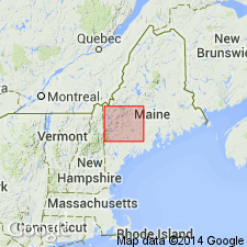
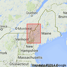
Geographically extended into northeastern VT. In Piermont-Frontenac allochthon, in Piermont sequence, rocks previously assigned to Albee Formation by Billings (1937), Eric and Dennis (1958), Johansson (1963), and Green (1964) in Moosilauke, Littleton, Guildhall, and Errol, NH, 15-min quads, and to Kidderville Formation by Hatch (1963) in Dixville, NH, 15-min quad, are here mapped as Rangeley Formation (undivided). Consists of slate, phyllite, or schist sharply interbedded with feldspathic quartzite; metasiltstone and metasandstone present in places. Age here is based on conformable position below Perry Mountain Formation and on probable correlation with fossil-dated member C of central Maine trough. Near Piermont, NH (southwest of map area), probably unconformably underlain by Greenvale Cove Formation. In western sequence of central Maine trough, divided into a main body, lower member near Woodstock (schist and granofels probably equivalent to member B), upper member near Woodstock (schist and granofels probably equivalent to member C), member A (in turn divided into gray shale and massive sandstone facies, massive sandstone facies, and polymict conglomerate facies), member B (in turn divided into quartz-rich, polymictic conglomerate facies and gray shale and sandstone facies), and member C (in turn divided into quartz conglomerate, sandstone, and gray shale; impure limestone and quartz conglomerate lenses; and upper gray shale and sandstone). Overall age of Rangeley is Silurian (Llandoverian, based on time scale of Harland and others (1989)). Fossils found in quartz-granule conglomerate lenses and laminated metalimestone of member C yield late Llandoverian age (A.J. Boucot, unpub. data). Underlying nonfossiliferous members A and B considered earlier Llandoverian. Corals found in boulders and fragments of brachiopods and small horn corals found in matrix of conglomerate in quartz-rich polymict conglomerate facies of member B in Cupsuptic quad (Harwood, 1973) are not age diagnostic, but are consistent with late Llandoverian age established for quartz conglomerate of Rangeley found in Kennebago quad. Quartz conglomerate and quartzite of member C, as mapped by Moench and Pankiwskyj (1988) near north end of Kennebago Lake, ME, are here reassigned to Clough Quartzite.
Source: GNU records (USGS DDS-6; Reston GNULEX).
- Usage in publication:
-
- Rangeley Formation*
- Modifications:
-
- Overview
- AAPG geologic province:
-
- New England province
Summary:
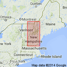
Used as Silurian (Llandoverian) Rangeley Formation. Mapped undivided and as eight subdivisions. Subdivisions include ribbon-banded calc-silicate of eastern NH (probable equivalent of Patch Mountain Member of Sangerville Formation of central ME); unnamed lower part of Rangeley, which consists of gray, thinly laminated metapelite with local lentils of turbidites and thin quartz conglomerates in western NH and sparse calc-silicate pods and coticule (probable equivalent of member B of Rangeley in ME); basaltic metavolcanics in Dixville region in Piermont allochthon; felsic metavolcanics in Dixville region in Piermont allochthon; schist matrix conglomerate within gray uppermost part of Rangeley in southwestern NH; pink to green, thinly bedded calc-silicate and purple biotite granofels close to transition from lower to upper parts of Rangeley; member C of Rangeley in northeastern NH and ME, consisting of quartz-pebble conglomerate overlain by rusty metapelite and feldspathic quartzite; and an unnamed upper part consisting of rusty-weathering pelitic schist, metasandstone, and local grits with common calc-silicate pods and minor coticule (probable equivalent of member C of Rangeley in ME). Unnamed calcsilicate and granofels unit is traced into Paxton Formation in north-central MA, where it was mapped as a "western belt" of Paxton and Littleton Formations on MA State Geologic Map by Zen and others (1983); rocks previously assigned to Paxton and Littleton Formations are now reassigned to Rangeley Formation in MA on the basis of more recent mapping (Robinson and Goldsmith, 1991). Aleinikoff and Moench (1987) determined an isotopic age of 432 +/-8 Ma using U/Pb methods on felsic metatuff from Rangeley. Report includes geologic map, cross sections, correlation chart, and four 1:500,000-scale derivative maps.
Source: GNU records (USGS DDS-6; Reston GNULEX).
For more information, please contact Nancy Stamm, Geologic Names Committee Secretary.
Asterisk (*) indicates published by U.S. Geological Survey authors.
"No current usage" (†) implies that a name has been abandoned or has fallen into disuse. Former usage and, if known, replacement name given in parentheses ( ).
Slash (/) indicates name conflicts with nomenclatural guidelines (CSN, 1933; ACSN, 1961, 1970; NACSN, 1983, 2005, 2021). May be explained within brackets ([ ]).

