

- Usage in publication:
-
- Prospect porphyritic gneiss*
- Modifications:
-
- Named
- Dominant lithology:
-
- Gneiss
- Granite
- AAPG geologic province:
-
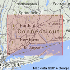
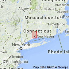
- New England province
Summary:
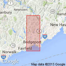
Unit described as a light-gray porphyritic gneiss, including small areas of porphyritic granite with inconspicuous gneissoid development and narrow bands of mica schist distributed unevenly. At its extreme northern limit, it is prevailingly less porphyritic and more quartzose and contains areas of intrusive basic rocks. Is believed to have been originally a mass of porphyritic granite intruded into Hartland (Hoosac) schist. Covers eastern part of Prospect Township. Age given as Ordovician(?).
Source: GNU records (USGS DDS-6; Reston GNULEX).
- Usage in publication:
-
- Prospect porphyritic gneiss
- Modifications:
-
- Revised
- AAPG geologic province:
-
- New England province
Summary:
Unit is restricted to the dark-gray biotite augen gneiss. The interbanded schists are considered part of undifferentiated Hartland formation. Prospect gneiss is always found at same stratigraphic position--between The Straits schist member and the quartzitic member of Hartland formation.
Source: GNU records (USGS DDS-6; Reston GNULEX).
- Usage in publication:
-
- Prospect Gneiss*
- Modifications:
-
- Revised
- Age modified
- AAPG geologic province:
-
- New England province
Summary:
Name changed from Prospect porphyritic gneiss to Prospect Gneiss. Intrudes the Straits Schist (redefined) and the Southington Mountain Schist (new). Age stated as Ordovician or Devonian.
Source: GNU records (USGS DDS-6; Reston GNULEX).
- Usage in publication:
-
- Prospect Gneiss*
- Modifications:
-
- Age modified
- AAPG geologic province:
-
- New England province
Summary:
Age changed from Ordovician or Devonian to Devonian.
Source: GNU records (USGS DDS-6; Reston GNULEX).
- Usage in publication:
-
- Prospect Formation
- Modifications:
-
- Revised
- Age modified
- AAPG geologic province:
-
- New England province
Summary:
Prospect Formation assigned to Hartland Group. Subdivided into newly named Golden Hill Schist Member, Beardsley Gneiss Member, and Pumpkin Ground Member. Age shown as Middle and Late Ordovician(?).
Source: GNU records (USGS DDS-6; Reston GNULEX).

- Usage in publication:
-
- Prospect Gneiss*
- Modifications:
-
- Geochronologic dating
- AAPG geologic province:
-
- New England province
Summary:
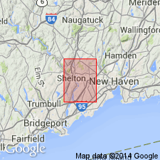
Pg. 15, geologic time scale (inside front cover). Prospect Gneiss. Two samples from gneiss in hydrothermally altered zone, and granodiorite gneiss, in Southington quadrangle, New Haven County, Connecticut, yielded Pb-alpha age of 450 +/-50 Ma (zircon); reconnaissance age, zircons may be detrital. Age published by Fritts (1962); recalculated using decay constants of Steiger and Jager, 1977 (Earth Planet. Sci. Letters, v. 36, p. 359-362).
Source: Publication.
- Usage in publication:
-
- Prospect Gneiss*
- Modifications:
-
- Revised
- Age modified
- AAPG geologic province:
-
- New England province
Summary:
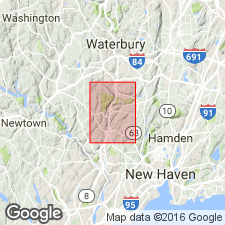
Prospect Gneiss is mapped in the Connecticut Valley synclinorium in CT and includes the Beardsley and Pumpkin Ground Members, elsewhere assigned to the Harrison Gneiss. Golden Hill Schist Member is removed from the Prospect and raised to formation rank as the Golden Hill Schist. Indicated age of the Prospect is Middle(?) Ordovician.
Source: GNU records (USGS DDS-6; Reston GNULEX).
- Usage in publication:
-
- Mt. Prospect [Prospect] Formation
- Modifications:
-
- Overview
- AAPG geologic province:
-
- New England province
Summary:
[It is the opinion of the reviewer that what the author refers to as the Mt. Prospect Formation of the Hartland Group, is actually the Prospect Formation, as the age, location, and lithologies appear similar. The Mount Prospect Complex occurs in the same area and is discussed at length in this article.] Author describes the unit as consisting of gray to brown, commonly rusty-weathering, thinly layered or laminated, sillimanite-garnet-muscovite-plagioclase-quartz-biotite schistose gneiss with subordinate, commonly laminated siliceous granulite, gray quartzite, biotite schist, local coticule, and garnet-cordierite-gedrite granulite. Also contains a mappable amphibolite unit, which is a dark-green, slabby, well foliated, quartz-labradorite-hornblende gneiss. The Hartland Group also includes the Mt. Rat Schist and the Bee Brook Formation in the Cameron's Line thrust sheet and the Litchfield Schist and the Mt. Tom Amphibolite in the Bantam Lake thrust sheet. Map symbol indicates a Cambrian(?) and Ordovician age.
Source: GNU records (USGS DDS-6; Reston GNULEX).
For more information, please contact Nancy Stamm, Geologic Names Committee Secretary.
Asterisk (*) indicates published by U.S. Geological Survey authors.
"No current usage" (†) implies that a name has been abandoned or has fallen into disuse. Former usage and, if known, replacement name given in parentheses ( ).
Slash (/) indicates name conflicts with nomenclatural guidelines (CSN, 1933; ACSN, 1961, 1970; NACSN, 1983, 2005, 2021). May be explained within brackets ([ ]).