

- Usage in publication:
-
- Patapsco formation
- Modifications:
-
- Named
- Dominant lithology:
-
- Clay
- Sand
- AAPG geologic province:
-
- Atlantic Coast basin
Summary:
Named the Patapsco formation of the Potomac group for the Patapsco River, MD. Consists of chiefly highly colored and variegated clays which grade over into lighter-colored sandy clays. Sandy bands of coarser materials are at times interstratified. The sands frequently contain much decomposed feldspar and less frequently rounded lumps of clay. The sands are often cross-bedded, and all deposits give evidence of shallow-water origin. Thickness is approximately 200 feet. Unit unconformably overlies the Arundel formation and unconformably overlies the Raritan formation. The Patapsco formation contains a rich Cretaceous flora and is of Early Cretaceous age.
Source: GNU records (USGS DDS-6; Reston GNULEX).
- Usage in publication:
-
- Patapsco formation*
- Modifications:
-
- Areal extent
- AAPG geologic province:
-
- Atlantic Coast basin
Summary:
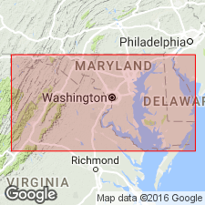
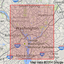
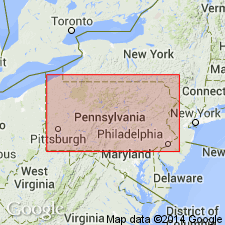
Geographically extended the Patapsco formation of the Potomac group to Washington, DC. Consists of maroon clay in the bottom part and sandy clay and sand in the upper part. Author states that there is some question that the basal clay may belong to the underlying Arundel formation. Unit unconformably overlies the Arundel formation of the Potomac group and unconformably underlies the Monmouth formation. The Patapsco is of Late Cretaceous age.
Source: GNU records (USGS DDS-6; Reston GNULEX).
- Usage in publication:
-
- Patapsco formation
- Modifications:
-
- Areal extent
- AAPG geologic province:
-
- Atlantic Coast basin
Summary:
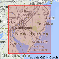
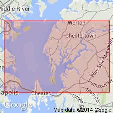
Geographically extended the Patapsco formation of the Potomac group to the subsurface of NJ. Consists of variegated clay and lenticular clayey sand. The Potomac group is difficult to divide in well section in NJ. Unit is of Early Cretaceous age.
Source: GNU records (USGS DDS-6; Reston GNULEX).
- Usage in publication:
-
- Patapsco Formation
- Modifications:
-
- Biostratigraphic dating
- AAPG geologic province:
-
- Atlantic Coast basin
Summary:
The Patapsco Formation of the Potomac Group consists of interlensing sands, silts, and clays with the clays being highly colored and variegated (red, gray, white, and chocolate). The clays grade rapidly upward and laterally into cross-bedded sands and silts; also contains thick lenses of lignitic clay that yields numerous plant fossils. Unit unconformably overlies the Arundel Formation or the Patuxent Formation where the Arundel is absent, and unconformably underlies the Raritan Formation. Spore and pollen data indicate that the Patapsco Formation is of Late Cretaceous (Albian) age.
Source: GNU records (USGS DDS-6; Reston GNULEX).
- Usage in publication:
-
- Patapsco(?) Formation
- Modifications:
-
- Areal extent
- AAPG geologic province:
-
- Atlantic Coast basin
Summary:
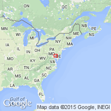
Geographically extended the Patapsco(?) Formation into extreme eastern PA. Unit identified to probably be Patapsco is variegated, ferruginous clay and minor sand beds that occur in isolated patches. The Patapsco(?) is considered of Early(?) Cretaceous age.
Source: GNU records (USGS DDS-6; Reston GNULEX).
- Usage in publication:
-
- Patapsco Formation
- Modifications:
-
- Overview
- AAPG geologic province:
-
- Atlantic Coast basin
Summary:
At the base of the Ken-Bf 180 core, from a depth of 480 ft to 476.3 ft is mottled, silty clay and lignitic wood containing a palynomorph assemblage that is considered to be late Albian (Zone IIC). This zone and Zone III (lower Cenomanian) have been assigned to the Early Cretaceous Elk Neck beds of the Patapsco Formation. The interval logged between 422.3 ft and 476.3 ft is composed of two pebbly sands of fluvial origin separated by a 4.2-ft micaceous, light-gray or yellowish-gray, silty clay. This interval is assigned to the Late Cretaceous Elk Neck Beds of the Patapsco Formation(?) and/or Raritan Formation for it contains specimens which are restricted to the middle Cenomanian Zone IV, usually assigned to the Raritan Formation. Lower Cenomanian Zone III (and the Elk Neck beds of this age) appear to be missing in this core. Overlying interval is assigned to the Late Cretaceous Magothy Formation.
Source: GNU records (USGS DDS-6; Reston GNULEX).
For more information, please contact Nancy Stamm, Geologic Names Committee Secretary.
Asterisk (*) indicates published by U.S. Geological Survey authors.
"No current usage" (†) implies that a name has been abandoned or has fallen into disuse. Former usage and, if known, replacement name given in parentheses ( ).
Slash (/) indicates name conflicts with nomenclatural guidelines (CSN, 1933; ACSN, 1961, 1970; NACSN, 1983, 2005, 2021). May be explained within brackets ([ ]).