

- Usage in publication:
-
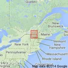
- Northfield slate†
- Modifications:
-
- Abandoned
- Dominant lithology:
-
- Slate
- AAPG geologic province:
-
- New England province
Summary:
Pg. 95. †Northfield slate; Early Ordovician (Beekmantown). [See 1906 entry under †Montpelier slate. Northfield is in Barre quadrangle, in Washington Co., northeastern VT.]
Source: US geologic names lexicon (USGS Bull. 896, p. 1512).
- Usage in publication:
-
- Northfield slate*
- Modifications:
-
- Principal reference
- Revised
- Dominant lithology:
-
- Slate
- AAPG geologic province:
-
- New England province
Summary:
Pg. 1492, 1501-1506. Northfield slate. Redefined to include, in general, beds previously mapped in central Vermont as "Memphremagog slates." Is mainly light- to dark-gray slate with scattered lenses and very thin beds of dense bluish-gray limestone and dolomitic limestone. Contains conglomerate at base ("Northfield conglomerate" of Richardson). Thin platy limestone beds above the conglomerate and two prominent zones of small siliceous nodules occur in lower part. Thickness 450 to 2,300 feet conformably underlies Waits River limestone; overlies Shaw Mountain formation (new) unconformably. Age is Ordovlcian(?). Origin of name given.
Source: US geologic names lexicon (USGS Bull. 1200, p. 2766-2767).
- Usage in publication:
-
- Northfield slate
- Modifications:
-
- Age modified
- AAPG geologic province:
-
- New England province
Summary:
Pg. 116 (fig. 16). Northfield slate. Age is Middle Ordovician.
Source: US geologic names lexicon (USGS Bull. 1200, p. 2766-2767).
- Usage in publication:
-
- Northfield slate*
- Modifications:
-
- Age modified
- Areal extent
- AAPG geologic province:
-
- New England province
Summary:
Northfield slate. Age is Silurian(?), based on new paleontologic and stratigraphic studies of Boucot and others [abs.], 1953, GSA Bull., v. 64, p. 1397-1398.
Source: Publication; US geologic names lexicon (USGS Bull. 1200, p. 2766-2767).
- Usage in publication:
-
- Northfield slate
- Modifications:
-
- Age modified
- Areal extent
- AAPG geologic province:
-
- New England province
Summary:
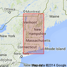
Pg. 551, pl. 3. Northfield slate. Discussion of stratigraphic and geotectonic relationships in northern Vermont and southern Quebec. Where Shaw Mountain formation is absent, Northfield slate lies directly, and to all appearances conformably, on Moretown formation. Age is Middle Silurian. Report includes geologic map, cross sections, correlation chart.
Source: US geologic names lexicon (USGS Bull. 1200, p. 2766-2767).
- Usage in publication:
-
- Northfield Formation*
- Modifications:
-
- Revised
- Areal extent
- AAPG geologic province:
-
- New England province
Summary:
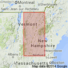
A unit of dark-gray, carbonaceous phyllite interbedded with minor thin (up to 15 cm) beds of punky-brown-weathering granulite and local thin, graded quartzite beds, which forms a narrow (0.5 to 1 km) unit along the west margin of the Connecticut Valley trough in E-C and NE Vermont, mapped as the Northfield Formation, has long been considered the basal unit of a synclinorium, underlying the Waits River Formation and equivalent to the Meetinghouse Slate on the east margin of the trough. It is here reinterpreted as a distal facies of the Gile Mountain Formation which is at the top of the Connecticut Valley trough sequence, here interpreted as a fault-bounded anticlinorium. The Meetinghouse Slate (Member of the Gile Mountain Formation of Doll and others (1961)) is also here interpreted as lying at the top of the sequence. Age is Early Devonian.
Source: GNU records (USGS DDS-6; Reston GNULEX).
- Usage in publication:
-
- Northfield Member*
- Modifications:
-
- Biostratigraphic dating
- AAPG geologic province:
-
- New England province
Summary:
Presence of plant fossils in northern NH and southern Quebec supports a late Early Devonian (Emsian) age for the Gile Mountain Formation and its equivalent, the Compton Formation. Gile Mountain includes the Meetinghouse Slate Member and the newly assigned Northfield Member, here considered a distal western facies of the Gile Mountain equivalent to the Meetinghouse. Authors conclude that the rocks of the Connecticut Valley trough accumulated continuously beginning as early as the Silurian and extending into the latest Early Devonian.
Source: GNU records (USGS DDS-6; Reston GNULEX).

- Usage in publication:
-
- Northfield Formation*
- Modifications:
-
- Areal extent
- AAPG geologic province:
-
- New England province
Summary:
Rocks of Connecticut Valley-Gaspe terrane occupy a broad area in eastern half of Glens Falls quad include Northfield, Waits River, and Gile Mountain Formations.
Source: GNU records (USGS DDS-6; Reston GNULEX).
- Usage in publication:
-
- Northfield Member*
- Modifications:
-
- Revised
- Age modified
- AAPG geologic province:
-
- New England province
Summary:
Structural studies in northeastern and east-central VT show that the belt long known as the Connecticut Valley synclinorium is a faulted anticline, and it is here renamed the Connecticut Valley trough. The Waits River Formation underlies the Gile Mountain Formation. The Northfield Formation and Meetinghouse Slate Member of the Gile Mountain Formation were interpreted as resting depositionally on older rocks to the west and east. The Northfield is revised as the Northfield Member of the Gile Mountain Formation, at the top of the Gile Mountain, rather than a separate formation below the Gile Mountain-Waits River package. The Meetinghouse Slate (Member of the Gile Mountain Formation of Doll and others (1961)) is revised as the Meetinghouse Slate Member of the Gile Mountain Formation, but at the top rather than at the bottom of the formation. The Standing Pond Volcanics (Standing Pond Volcanic Member of the Waits River Formation of Doll and others (1961)) is retained as the Standing Pond Volcanic Member of the Waits River. The age of all trough rocks is modified to Early Devonian.
Source: GNU records (USGS DDS-6; Reston GNULEX).
- Usage in publication:
-
- Northfield Formation*
- Modifications:
-
- Mapped
- Dominant lithology:
-
- Schist
- Phyllite
- AAPG geologic province:
-
- New England province
Summary:
Northfield Formation. In West Dover and Jacksonville quadrangles, Vermont, consists of gray to dark-gray, graphitic, garnet-chlorite-quartz-muscovite-pyrite schist and phyllite. Locally, unit includes 10 cm to 1 m thick vitreous, white-weathering, light-gray quartzite with abundant blue quartz grains. Lower part of unit is locally intruded by the Whitneyville facies of the North River Igneous Suite. Age is Silurian(?) and Devonian.
Source: Modified from GNU records (USGS DDS-6; Reston GNULEX).
For more information, please contact Nancy Stamm, Geologic Names Committee Secretary.
Asterisk (*) indicates published by U.S. Geological Survey authors.
"No current usage" (†) implies that a name has been abandoned or has fallen into disuse. Former usage and, if known, replacement name given in parentheses ( ).
Slash (/) indicates name conflicts with nomenclatural guidelines (CSN, 1933; ACSN, 1961, 1970; NACSN, 1983, 2005, 2021). May be explained within brackets ([ ]).