

- Usage in publication:
-
- Neshoba sand member
- Modifications:
-
- Original reference
- Dominant lithology:
-
- Sand
- AAPG geologic province:
-
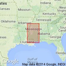
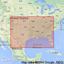
- Mid-Gulf Coast basin
Thomas, E.P., 1942, The Claiborne: Mississippi Geological Survey Bulletin, no. 48, 96 p.
Summary:
Pg. 24-28, fig. 1, pl. 2, profile C. Neshoba sand member of Tallahatta formation. Name applied to section of non-glauconitic to sparingly glauconitic sand heretofore considered to be lower Winona. Sands are typically well-sorted, fine-grained, and micaceous; massive to irregularly bedded to cross-bedded. When fresh, sands are white, but on outcrop they are commonly stained red, brown, yellow, purple, and mottled; gray clay abundant in form of pellets, partings, stringers, and lenses. Overlies Basic claystone member and is stratigraphic equivalent of part of type Basic claystone in Mississippi and of part of type Tallahatta section of Choctaw County, Alabama. Overlain and underlain by typical Basic material in Newton and Lauderdale Counties, southeastern Mississippi. Neshoba and Basic facies are interlensed over wide area, and thickness of Neshoba fluctuates inversely with thickness of the Basic. [Age is middle Eocene.]
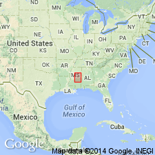
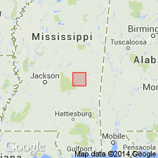
Type section: above Basic claystone and below Winona greensand along highway through Neshoba, Neshoba Co., southeastern MS.
Source: US geologic names lexicon (USGS Bull. 1200, p. 2707).
- Usage in publication:
-
- Neshoba sand
- Modifications:
-
- Revised
- AAPG geologic province:
-
- Mid-Gulf Coast basin
Summary:
Neshoba sand of Claiborne group. Mapped as Neshoba sand in Claiborne group. Not recognized southeast of Newton County, southeastern Mississippi, or north of Yalobusha River. [Age is middle Eocene.]
Source: US geologic names lexicon (USGS Bull. 1200, p. 2707).
- Usage in publication:
-
- Neshoba sand member*
- Modifications:
-
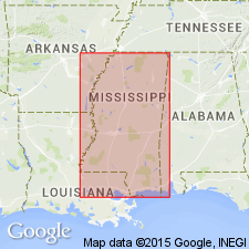
- Areal extent
- AAPG geologic province:
-
- Mid-Gulf Coast basin
Summary:
Correlation chart shows Neshoba sand member at top of Tallahatta formation; overlies Basic City shale member of Tallahatta; underlies Winona formation. [Age is middle Eocene.]
Source: US geologic names lexicon (USGS Bull. 1200, p. 2707).
- Usage in publication:
-
- Neshoba Sand Member
- Modifications:
-
- Areal extent
- AAPG geologic province:
-
- Mid-Gulf Coast basin
Summary:
Tallahatta Formation of Claiborne Group in Newton Co., MS, divided into lower Basic City Shale Member and upper Neshoba Sand Member. Neshoba is not encountered at the surface in Clarke Co., and is not considered a separate geologic unit in Lauderdale Co. Unit as exposed in study area is typically moderate- to dark reddish-brown, coarse- to fine-grained, consistently micaceous, locally glauconitic, massive, nonfossiliferous sand. Usually has mottled appearance. In the subsurface, it is typically grayish-orange, very coarse- to fine-grained, poorly sorted, subangular quartz sand, with appreciable glauconite and mica. Generally 10 ft thick; 15 ft in Test Hole A0-9. Contact with Basic City Shale Member is conformable. Upper contact with Winona Formation is disconformable. Represents a coarsening upward sequence of sediments produced as the sea regressed in a deltaic and strandplain environment. Measured section. Geologic map. Stratigraphic column.
Source: GNU records (USGS DDS-6; Reston GNULEX).
- Usage in publication:
-
- Neshoba Sand Member
- Modifications:
-
- Overview
- AAPG geologic province:
-
- Mid-Gulf Coast basin
Summary:
Neshoba Sand Member of Tallahatta Formation. Overlies and intertongues with Basic City Shale Member of Tallahatta; unconformably underlies Winona Formation. Equivalent to part of Cane River Formation of downdip (south) area. All included in Claiborne Group. Age is latest early Eocene (late Ypresian); nannofossil zones NP14 to NP15, planktic foram zones P9 (uppermost) and P10 (H. ARAGONENSIS zone).
[Base of Neshoba in updip (north) area closely corresponds to early-middle Eocene boundary of Berggren and Pearson, 2005, Jour. Foram. Research, v. 35, no. 4, p. 290 (fig. 2), 291.]
Source: Publication.
For more information, please contact Nancy Stamm, Geologic Names Committee Secretary.
Asterisk (*) indicates published by U.S. Geological Survey authors.
"No current usage" (†) implies that a name has been abandoned or has fallen into disuse. Former usage and, if known, replacement name given in parentheses ( ).
Slash (/) indicates name conflicts with nomenclatural guidelines (CSN, 1933; ACSN, 1961, 1970; NACSN, 1983, 2005, 2021). May be explained within brackets ([ ]).