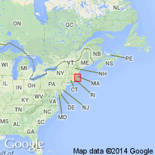
- Usage in publication:
-
- Nahant Gabbro*
- Modifications:
-
- Overview
- AAPG geologic province:
-
- New England province
Summary:
Used as Nahant Gabbro of Ordovician age. Mapped with gabbro at Salem Neck. Intrudes rocks mapped as Lower and Middle Cambrian Braintree Argillite and Weymouth Formation, undivided.
Source: GNU records (USGS DDS-6; Reston GNULEX).

- Usage in publication:
-
- Nahant Gabbro*
- Modifications:
-
- Overview
- Geochronologic dating
- AAPG geologic province:
-
- New England province
Summary:
Nahant Gabbro intrudes Early Cambrian Weymouth Formation at Nahant and thus is younger than gabbroic or dioritic rocks intruded by Late Proterozoic Dedham Granite or Topsfield Granite. Unrecognized equivalents to Nahant Gabbro at Nahant and at Salem Neck may be present within unnamed gabbro and diorite units shown on MA State geologic map (Zen and others, 1983). Mapped as three facies at Nahant, following usage of Bell (1977): pyroxene gabbro, olivine gabbro, and quartz diorite. Biotite from olivine gabbro was analyzed by Rb-Sr and K-Ar methods and yielded an Ordovician age (450 +/-13 Ma by Rb-Sr methods, 483 +/-21 Ma by K-Ar methods). Quartz diorite phase may be a more mafic phase of Dedham Granite. Report includes geologic maps. [Papers presented as chapters in U.S. Geological Survey Professional Paper 1366 are intended as explanations and (or) revisions to MA State bedrock geologic map of Zen and others (1983) at scale of 1:250,000. Radiometric dates are from an unknown source; although table 1 of this chapter refers the reader to chapter J of this volume by Marvin and Zartman for more information, these dates do not appear in Marvin and Zartman's chapter.]
Source: GNU records (USGS DDS-6; Reston GNULEX).
For more information, please contact Nancy Stamm, Geologic Names Committee Secretary.
Asterisk (*) indicates published by U.S. Geological Survey authors.
"No current usage" (†) implies that a name has been abandoned or has fallen into disuse. Former usage and, if known, replacement name given in parentheses ( ).
Slash (/) indicates name conflicts with nomenclatural guidelines (CSN, 1933; ACSN, 1961, 1970; NACSN, 1983, 2005, 2021). May be explained within brackets ([ ]).

