The National Geologic Map Database is migrating to a new infrastructure. We apologize for any service disruptions during this process.
|
|---|


- Usage in publication:
-
- Milford Granite*
- Modifications:
-
- Age modified
- Geochronologic dating
- Areal extent
- AAPG geologic province:
-
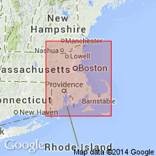
- New England province
Summary:
Age changed to Proterozoic Z based on U-Th-Pb radiometric age determinations on zircons from Milford Granite by R.E. Zartman and R.S. Naylor (1978, written commun.). Although Emerson and Perry (1907) originally showed the Milford to occur in RI, Quinn (1971) does not recognize the Milford there. Granite that Emerson (1917) mapped as Milford in RI is now mapped as Esmond Granite (Quinn, 1971). Milford is therefore restricted from RI.
Source: GNU records (USGS DDS-6; Reston GNULEX).

- Usage in publication:
-
- Milford Granite*
- Modifications:
-
- Overview
- AAPG geologic province:
-
- New England province
Summary:
Used as Milford Granite of Proterozoic Z age. Informally subdivided into a biotite granite and a mafic phase granite to granodiorite, both of which intrude Blackstone Group rocks.
Source: GNU records (USGS DDS-6; Reston GNULEX).
- Usage in publication:
-
- Milford Granite*
- Modifications:
-
- Overview
- Geochronologic dating
- AAPG geologic province:
-
- New England province
Summary:
Occupies an area of about 100 sq km. Central mass near Milford is elliptical and is divided into and mapped as a light-colored phase and a dark-colored phase; dark-colored phase defines an irregular border for largest of light-colored plutons. Intrudes Blackstone Group rocks and Ponaganset Gneiss, but was deformed with them at some later unknown time. Isotopic age of 630 +/-15 Ma was determined using U-Pb methods on zircon by Zartman and Naylor (1984). Characterized by salmon-pink color, bluish quartz on weathered surfaces, and lineations defined by lenticular mosaics of quartz and oriented patches of biotite; texture contrast strongly with that of Dedham Granite. Report includes geologic maps. [Papers presented as chapters in U.S. Geological Survey Professional Paper 1366 are intended as explanations and (or) revisions to MA State bedrock geologic map of Zen and others (1983) at scale of 1:250,000.]
Source: GNU records (USGS DDS-6; Reston GNULEX).
For more information, please contact Nancy Stamm, Geologic Names Committee Secretary.
Asterisk (*) indicates published by U.S. Geological Survey authors.
"No current usage" (†) implies that a name has been abandoned or has fallen into disuse. Former usage and, if known, replacement name given in parentheses ( ).
Slash (/) indicates name conflicts with nomenclatural guidelines (CSN, 1933; ACSN, 1961, 1970; NACSN, 1983, 2005, 2021). May be explained within brackets ([ ]).