

- Usage in publication:
-
- Madrid formation
- Modifications:
-
- Named
- Dominant lithology:
-
- Quartzite
- AAPG geologic province:
-
- New England province
Summary:
Probably named for Madrid, ME. Consists of calcareous quartzite with lime-silicate minerals in middle-grade metamorphic zones. Contains minor amounts of argillaceous rocks and calcareous beds. Sulfides absent or inconspicuous. Quartzite grades upward into Dyer Hill member (new). Age is younger than Parmachenee formation (new).
Source: GNU records (USGS DDS-6; Reston GNULEX).

- Usage in publication:
-
- Madrid Formation*
- Modifications:
-
- Revised
- AAPG geologic province:
-
- New England province
Summary:
Madrid Formation, eastern facies, replaces use of Fall Brook Formation, which is here abandoned.
Source: GNU records (USGS DDS-6; Reston GNULEX).
- Usage in publication:
-
- Madrid Formation*
- Modifications:
-
- Revised
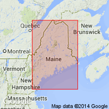
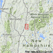
- Areal extent
- AAPG geologic province:
-
- New England province
Summary:
Stratigraphy differs radically from that of Hadley (1942, 1950), White and Billings (1952), in Mt. Cube and Woodsville 15-min quads, respectively, and revisions of Rumble (1942) east of Connecticut River. Fundamental difference is that Moench recognizes seven formations (plus members) that constitute Piermont allochthon. Hadley (1942) mapped all of these as Albee Formation, a name not used in this report. Rocks previously mapped as Albee are reassigned to stratigraphic equivalents of Quimby (Upper Ordovician?), Greenvale Cove (Lower Silurian), Rangeley (Lower Silurian), Perry Mountain (Silurian), Smalls Falls (Upper Silurian), Madrid (Upper Silurian?), and Littleton (Lower Devonian) Formations, whose type localities, except for Littleton, are near Rangeley, ME (Moench and Boudette, 1987). Madrid is poorly exposed in Piermont allochthon. Maximum thickness there is about 200 m, somewhat thinner than in western ME. Consists of metasandstone and calcareous schist. Report includes geologic map and correlation chart.
Source: GNU records (USGS DDS-6; Reston GNULEX).

- Usage in publication:
-
- Madrid Formation*
- Modifications:
-
- Revised
- Age modified
- Areal extent
- Dominant lithology:
-
- Sandstone
- Siltstone
- Greenstone
- AAPG geologic province:
-
- New England province
Summary:
Geographically extended into NH north of Littleton in Piermont-Frontenac allochthon. In Piermont sequence of allochthon, includes rocks previously assigned to Albee Formation by Billings (1956) (see Albee record for more information); mapped as lenses (<60 m thick) of purply gray or brownish-weathering, weakly calcareous laminated and thinly bedded feldspathic metasiltstone, and local felsite and basaltic greenstone, and thick beds of fine-grained feldspathic metasandstone with lenses of calc-silicate rocks similar to Madrid mapped in central Maine trough. Separately mapped from Smalls Falls Formation at Townshend Mountain, Littleton, NH, quad; on Mud Pond Ridge, Dixville, NH, quad; and on Round Mountain and Burnside Mountain, Guildhall, NH, quad. Mapped with Smalls Falls on south side of Foster Hill, Littleton quad. At Foster Hill, consists of brownish-gray-weathering, weakly calcareous, laminated slate and metasiltstone; tuffaceous metasandstone; and brownish-weathering, calcitic greenstone. In central Maine trough in western sequence, Madrid is divided into unmapped upper sandstone member and lower calcareous member. Age here is based on conformable position below Lower Devonian Carrabassett Formation and above Silurian Smalls Falls Formation, and by correlation with fossil-dated Fitch Formation. Eastern sequence is similar to upper sandstone member of type Madrid, but lacks lower calcareous member; consists of thickly bedded, light-purplish-gray, massive, well-sorted, weakly calcareous metasandstone. Age everywhere on map is Silurian(?) (Ludlovian? and Pridolian? using time scale of Harland and others (1989)).
Source: GNU records (USGS DDS-6; Reston GNULEX).

- Usage in publication:
-
- Madrid Formation*
- Modifications:
-
- Overview
- AAPG geologic province:
-
- New England province
Summary:
Used as Late Silurian(?) Madrid Formation. Consists of purple, massive to weakly foliated biotite-feldspar granofels, layered calc-silicate, and dark pelitic-sulfidic schist with calc-silicate pods in upper member. Considered an eastern facies equivalent of upper part of Fitch Formation. Locally mapped as Warner Formation of Nielson (1981) in southern NH. Mapped undivided with Smalls Falls Formation in places. Report includes geologic map, cross sections, correlation chart, and four 1:500,000-scale derivative maps.
Source: GNU records (USGS DDS-6; Reston GNULEX).
For more information, please contact Nancy Stamm, Geologic Names Committee Secretary.
Asterisk (*) indicates published by U.S. Geological Survey authors.
"No current usage" (†) implies that a name has been abandoned or has fallen into disuse. Former usage and, if known, replacement name given in parentheses ( ).
Slash (/) indicates name conflicts with nomenclatural guidelines (CSN, 1933; ACSN, 1961, 1970; NACSN, 1983, 2005, 2021). May be explained within brackets ([ ]).