

- Usage in publication:
-
- Leipers formation*
- Modifications:
-
- Named
- Dominant lithology:
-
- Limestone
- AAPG geologic province:
-
- Cincinnati arch
Summary:
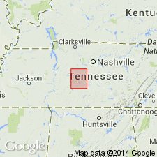
Named Leipers formation. In eastern half of quadrangle, knotty, earthy limestone at top, with similar but more shaly and highly fossiliferous beds below. In western half, nearly uniform granular crystalline limestone, the more granular portions more phosphatic. 0-100 ft thick. Unconformably overlain by Fernvale formation, unconformably underlain by Catheys formation.
Source: GNU records (USGS DDS-6; Reston GNULEX).
- Usage in publication:
-
- Leipers Limestone*
- Modifications:
-
- Areal extent
- AAPG geologic province:
-
- Cincinnati arch
Summary:
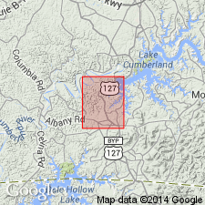
Use of Leipers Limestone extended into south central Kentucky. Consists of bluish-gray to light-gray, arenaceous and argillaceous, medium- to coarse-grained, very fossiliferous limestone; contains few thin lenses of bluish-gray very fine grained relatively pure limestone. 80 ft thick.
Source: GNU records (USGS DDS-6; Reston GNULEX).
- Usage in publication:
-
- Leipers limestone*
- Modifications:
-
- Areal extent
- AAPG geologic province:
-
- Cincinnati arch
Summary:
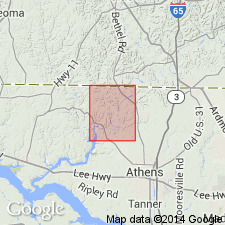
Leipers limestone extended into northern Alabama.
Source: GNU records (USGS DDS-6; Reston GNULEX).
- Usage in publication:
-
- Leipers
- Modifications:
-
- Areal extent
- AAPG geologic province:
-
- Appalachian basin
Summary:
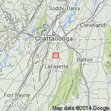
Shown in table 1 as occurring in GA. Table shows that Leipers was previously called Chickamauga Formation, Maysville, or Sequatchie. Detailed mapping of Chickamauga Valley near southern edge of Chickamauga, northwestern GA. [Rank terms not given for some formations, including Leipers; therefore, it is unclear as to whether authors intended to use this as Leipers Formation or Limestone.]
Source: GNU records (USGS DDS-6; Reston GNULEX).
- Usage in publication:
-
- Leipers Limestone
- Modifications:
-
- Areal extent
- AAPG geologic province:
-
- Appalachian basin
Summary:
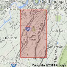
Leipers Formation is exposed in abandoned quarry near eastbound lane of I-24, Dade Co., northwestern GA, approx 0.5 mi from Hamilton Co., TN border. Consists of 1) shale, indicating a suspension sedimentation-low supratidal-high subtidal environment; 2) fossiliferous micrite, indicating a suspension sedimentation-high supratidal-low subtidal environment; 3) pelsparite, indicating an intertidal environment; and 4) biosparite (containing gastropod and coral fragments), indicating a low intertidal to high subtidal environment. Includes generalized stratigraphic section of Leipers at quarry site and detailed description.
Source: GNU records (USGS DDS-6; Reston GNULEX).

- Usage in publication:
-
- Leipers Limestone*
- Modifications:
-
- Revised
- AAPG geologic province:
-
- Appalachian basin
Summary:
The Leipers Limestone is assigned to the Chickamauga Group in the Chickamauga terrane in AL, as used by Drahovzal and Neathery (1971). It overlies the Inman Formation of the Chickamauga Group and underlies the Sequatchie Formation.
Source: GNU records (USGS DDS-6; Reston GNULEX).

- Usage in publication:
-
- Leipers Formation*
- Modifications:
-
- Overview
- AAPG geologic province:
-
- Cincinnati arch
Summary:
The Leipers Formation in central Tennessee consists of an argillaceous facies (various types of argillaceous limestone), granular facies (dark blue, massive, coarse-grained limestone), and pale colored facies (dark blue, pale weathering, fine-grained, dense limestone). The granular facies dominates in the western part of central TN, the argillaceous facies dominates the lower part of the formation in the east, and the pale colored facies dominates in the upper part of the formation in the east. Thickness is generally less that 75 feet but reaches 175 feet in northern most TN. Overlies the Catheys Formation of the Nashville Group or the Inman Formation to the east. The environment of deposition is interpreted to be a westward shoaling bank with a broad lagoon to the east. The Leipers is of Late Ordovician (Edenian and Maysvillian) age.
Source: GNU records (USGS DDS-6; Reston GNULEX).

- Usage in publication:
-
- Leipers Limestone*
- Modifications:
-
- Age modified
- AAPG geologic province:
-
- Cincinnati arch
Summary:
Age of Leipers Limestone is refined to Cincinnatian (Edenian and Maysvillian).
Source: GNU records (USGS DDS-6; Reston GNULEX).
For more information, please contact Nancy Stamm, Geologic Names Committee Secretary.
Asterisk (*) indicates published by U.S. Geological Survey authors.
"No current usage" (†) implies that a name has been abandoned or has fallen into disuse. Former usage and, if known, replacement name given in parentheses ( ).
Slash (/) indicates name conflicts with nomenclatural guidelines (CSN, 1933; ACSN, 1961, 1970; NACSN, 1983, 2005, 2021). May be explained within brackets ([ ]).