- Usage in publication:
-
- Keweenawan Supergroup*
- Modifications:
-
- Overview
- AAPG geologic province:
-
- Lake Superior region
Summary:
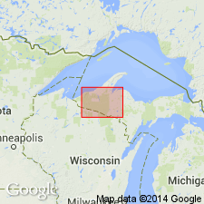
In Iron River area of northern MI in the Lake Superior region is divided into Powder Mill Group (base), middle Keweenawan rocks (unranked), and Oronto Group (top). Bounded above and below by angular unconformity. Keweenaw fault separates two distinct but correlative sequences on basis of indirect means. Underlies undivided Paleozoic rocks and overlies Marquette Range Supergroup. Geologic map and correlation of rocks units. Is of Middle Proterozoic age.
Source: GNU records (USGS DDS-6; Reston GNULEX).

- Usage in publication:
-
- Keweenawan Supergroup
- Modifications:
-
- Not used
Summary:
Name Keweenawan Supergroup not used for Middle Proterozoic rocks in Lake Superior province in parts of northern MI and WI and in MN in the Lake Superior region. Interval informally referred to as time of Keweenawan igneous activity, Keweenawan sequence, or succession of the Midcontinent rift system. Authors feel nomenclature is not adequately defined. Is Middle Proterozoic in age.
Source: GNU records (USGS DDS-6; Reston GNULEX).

- Usage in publication:
-
- Keweenawan Supergroup
- Modifications:
-
- Areal extent
- Age modified
- Overview
- AAPG geologic province:
-
- Sedgwick basin
- Forest City basin
- Salina basin
- Iowa shelf
Summary:
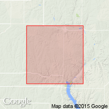
Rocks associated with the Precambrian Midcontinent rift system (MRS) are already identified as exposures in the Lake Superior region: northeastern MN, northern WI, northern MI, and Ontario. Here, they are found in subsurface from south-central KS northward through northeastern KS, east-central NE, southwestern and central IA, and southeastern MN (Dickas, 1984, 1986; Van Schmus and Hinze, 1985). Age confirmed and refined based on 1097.5+/-3 Ma gabbro sill, which intrudes upper volcanic sequence of Middle Proterozoic Keweenawan Supergroup. Magnetic polarity of the gabbro correlates with lower Keweenawan rocks in northern MRS (Van Schmus and others, 1990). Additionally, age range of igneous and sedimentary activity in the rift thought to be 1109-1087 Ma (Davis and Sutcliffe, 1985; Palmer and Davis, 1987; Davis and Paces, 1990; Van Schmus, 1992). Subsurface rocks are recognized by large gravity and magnetic anomalies, presumably reflecting abundance of basalts along rift (Van Schmus and Hinze, 1985). Stratigraphic succession at the Poersch (Berendsen and others, 1988) and nearby OZ wells appears to be interrupted by a high-angle reverse fault, causing younger sedimentary rocks to be juxtaposed beneath older mafic volcanic and intrusive rocks. Came the rift with an outpouring of 4000 ft (1200 m) of basalt laced with minor felsite and interflow siltstone; then followed deposition of no less than 4000 ft (1200 m) of arkoses and siltstones, much of which derived from rift shoulders. Neither top nor bottom of sections were revealed thus, total thickness of basal sedimentary and upper volcanic Keweenawan Supergroup is not known. Presumed unconformity at its top separates it from overlying Paleozoic sedimentary rocks. Report includes schematic columnar section and sketch map of MRS.
Source: GNU records (USGS DDS-6; Reston GNULEX).
For more information, please contact Nancy Stamm, Geologic Names Committee Secretary.
Asterisk (*) indicates published by U.S. Geological Survey authors.
"No current usage" (†) implies that a name has been abandoned or has fallen into disuse. Former usage and, if known, replacement name given in parentheses ( ).
Slash (/) indicates name conflicts with nomenclatural guidelines (CSN, 1933; ACSN, 1961, 1970; NACSN, 1983, 2005, 2021). May be explained within brackets ([ ]).

