

- Usage in publication:
-
- Hothouse formation
- Modifications:
-
- Named
- Dominant lithology:
-
- Metagraywacke
- Quartzite
- Metaconglomerate
- Schist
- AAPG geologic province:
-
- Piedmont-Blue Ridge province
Summary:
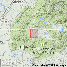
Named Hothouse formation of the Great Smoky group for Hothouse Creek, Mineral Bluff quad, Fannin Co., GA. Occurs in northernmost GA and southwestern NC. Consists of interbedded metagraywacke, quartzite, and metaconglomerate at top; downward, these beds become less prominent. The base is principally mica schist. Thickness of unit is estimated between 8000 and 11,000 feet. The Hothouse underlies the Dean formation and overlies the Hughes Gap formation. Report contains geologic map. correlation chart, and extensive mineral analyses. Unit is considered of Precambrian age.
Source: GNU records (USGS DDS-6; Reston GNULEX).

- Usage in publication:
-
- Hothouse Formation
- Modifications:
-
- Overview
- AAPG geologic province:
-
- Appalachian basin
Summary:
Near Ducktown, TN, Precambrian Great Smoky Group of Ocoee Supergroup is mapped undivided and includes (ascending) Copperhill, Hughes Gap, Hothouse, and Dean Formations.
Source: GNU records (USGS DDS-6; Reston GNULEX).
- Usage in publication:
-
- Hothouse Formation
- Modifications:
-
- Overview
- AAPG geologic province:
-
- Piedmont-Blue Ridge province
Summary:
Correlation chart (fig. 2) shows the following relations. The Great Smoky Group in western NC consists of five formations (ascending): Thunderhead, Anakeesta, Grassy Branch (new name), Ammons (new name), and Dean Formations (chart implies that Dean and top of Ammons are time equivalent). Grassy Branch Formation is applied to unnamed beds mapped by King and others (1958) above Anakeesta Formation. In relation to Great Smoky Group mapped by Hurst (1955) in Mineral Bluff quad, GA, Anakeesta correlates with Copperhill Formation, Grassy Branch correlates with Hughes Gap Formation, and Ammons correlates with Hothouse and Dean Formations.
Source: GNU records (USGS DDS-6; Reston GNULEX).
- Usage in publication:
-
- Hothouse Formation
- Modifications:
-
- Overview
- AAPG geologic province:
-
- Piedmont-Blue Ridge province
Summary:
Metasandstone, metagraywacke, metasiltstone, and mica schist are lumped together as one unit within Late Proterozoic Great Smoky Group in Blue Ridge belt. Unit includes Hughes Gap and Hothouse Formations in southern area, Horse Branch Member of Ammons Formation and Grassy Branch Formation in northern area. [Copied from map text, is ambiguous about the rest of the Ammons.]
Source: GNU records (USGS DDS-6; Reston GNULEX).

- Usage in publication:
-
- Hothouse Formation*
- Modifications:
-
- Overview
- AAPG geologic province:
-
- Piedmont-Blue Ridge province
Summary:
The Hothouse Formation of Hurst (1955) of the Great Smoky Group is accepted for USGS use in the Bill Arp thrust sheet in the Murphy synclinorium in northern GA. Age is Late Proterozoic.
Source: GNU records (USGS DDS-6; Reston GNULEX).
For more information, please contact Nancy Stamm, Geologic Names Committee Secretary.
Asterisk (*) indicates published by U.S. Geological Survey authors.
"No current usage" (†) implies that a name has been abandoned or has fallen into disuse. Former usage and, if known, replacement name given in parentheses ( ).
Slash (/) indicates name conflicts with nomenclatural guidelines (CSN, 1933; ACSN, 1961, 1970; NACSN, 1983, 2005, 2021). May be explained within brackets ([ ]).