The National Geologic Map Database is migrating to a new infrastructure. We apologize for any service disruptions during this process.
|
|---|


- Usage in publication:
-
- Green Lodge Formation**
- Modifications:
-
- Overview
- AAPG geologic province:
-
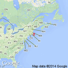
- New England province
Summary:
Used as Green Lodge Formation of Rhodes and Graves (1931) [implies nonacceptance by USGS as a formal name] of Early Cambrian(?) age. Consists of quartzite and slate. Contains fossils of questionable Late Cambrian age.
Source: GNU records (USGS DDS-6; Reston GNULEX).
- Usage in publication:
-
- Green Lodge Formation*
- Modifications:
-
- Overview
- AAPG geologic province:
-
- New England province
Summary:
Used throughout report as Green Lodge Formation of Rhodes and Graves (1931) [implying that USGS does not recognize it as a formal name]. Named by Rhodes and Graves (1931) for quartzite containing poorly preserved brachiopod impressions near Dedham, MA. Fossiliferous quartzite is in a sequence of light-gray quartzite overlain by dark-gray phyllite containing siltstone laminae and thin layers of siltstone containing limonite-bearing pits. Sequence was exposed in hill south of MA Hwy 128 near Westwood-Dedham town line. Rhodes and Graves assigned the formation a Late Cambrian age on basis of fossil impressions. Shaw (1961) examined the fossils and stated that they were too poorly preserved for reliable assignment. Therefore, Green Lodge is shown as questionably Late Cambrian on MA State Bedrock map (Zen and others, 1983). Outcrops are no longer accessible due to construction. Rhodes and Graves (1931) estimated thickness of Green Lodge to be not less than 300 m. Chute (1964) estimated about 150 m of phyllite overlying an undetermined thickness of quartzite. He also mapped similar phyllite on main Amtrak railroad line in southern Norwood, MA, but did not correlate it with Green Lodge. Green Lodge may be more extensive beneath glacial drift than it appears; it is shown on State bedrock map as covering a larger area than shown by either Rhodes and Graves (1931) or Chute (1964). Age remains Late Cambrian(?). Report includes geologic maps and correlation charts. [Chapters A-J in U.S. Geological Survey Professional Paper 1366 are intended as explanations and (or) revisions to 1:250,000-scale MA State bedrock geologic map of Zen and others (1983).]
Source: GNU records (USGS DDS-6; Reston GNULEX).
- Usage in publication:
-
- Green Lodge Formation*
- Modifications:
-
- Age modified
- AAPG geologic province:
-
- New England province
Summary:
Green Lodge Formation is Late Cambrian based on brachiopods. [Absence of "of Rhodes and Graves (1931)" implies acceptance by USGS. Belated entry--actual review done by EGH of USGS geologic names unit in 1989.]
Source: GNU records (USGS DDS-6; Reston GNULEX).
For more information, please contact Nancy Stamm, Geologic Names Committee Secretary.
Asterisk (*) indicates published by U.S. Geological Survey authors.
"No current usage" (†) implies that a name has been abandoned or has fallen into disuse. Former usage and, if known, replacement name given in parentheses ( ).
Slash (/) indicates name conflicts with nomenclatural guidelines (CSN, 1933; ACSN, 1961, 1970; NACSN, 1983, 2005, 2021). May be explained within brackets ([ ]).