

- Usage in publication:
-
- Grant Lake Limestone*
- Modifications:
-
- Named
- Dominant lithology:
-
- Limestone
- Shale
- AAPG geologic province:
-
- Cincinnati arch
Summary:
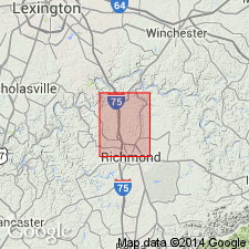
Named for Grant Lake, near Orangeburg, Mason Co, KY. Gray thinly and irregularly bedded limestone and minor shale. 109 ft thick at type section. Conformably overlies Fairview Formation; conformably underlies Bull Fork Formation. Lower part grades southward into upper part of Calloway Creek Limestone and upper part into Ashlock Formation.
Source: GNU records (USGS DDS-6; Reston GNULEX).
- Usage in publication:
-
- Grant Lake Member*
- Modifications:
-
- Revised
- AAPG geologic province:
-
- Cincinnati arch
Summary:
Grant Lake Member of Ashlock Formation. In Richmond North quadrangle, Grant Lake Limestone reduced to member rank and included in Ashlock Formation where it overlies Tate Member and underlies Terrill Member. In its type locality and southward to vicinity of Owingsville, Kentucky, it is recognized as unit of formational rank. [Age is Late Ordovician.]
Source: US geologic names lexicon (USGS Bull. 1350, p. 304-305).
- Usage in publication:
-
- Grant Lake Limestone
- Modifications:
-
- Revised
- Overview
- AAPG geologic province:
-
- Cincinnati arch
Summary:
According to authors, the Ohio Division of Geological Survey regards the Bellevue, Corryville, Mount Auburn, and Straight Creek members of the Grant Lake Limestone as informal stratigraphic units. The Cincinnati Group proposed by Meek and Worthen (1865), to which the Grant Lake is assigned, has been tentatively adopted, but as an informal unit. The Cincinnati will be formally reinstated as a lithostratigraphic term in southwestern OH once the revision of its lower boundary and minor lithologic redescription of its units are completed.
Source: GNU records (USGS DDS-6; Reston GNULEX).
- Usage in publication:
-
- Grant Lake Limestone/Formation
- Modifications:
-
- Principal reference
- Revised
- Redescribed
- AAPG geologic province:
-
- Appalachian basin
Summary:
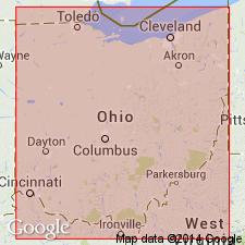
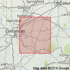
Grant Lake Limestone and Grant Lake Formation are adopted by the Ohio Geological Survey for southwestern OH. The shale content of the Grant Lake Limestone progressively increases between Maysville, KY, and Cincinnati, OH. The term Grant Lake Formation is used where the unit becomes predominantly shale (50 to 60%). The Grant Lake Formation is divided into (ascending) Bellevue, Corryville, and Mount Auburn Members. Name is applied in Butler, Hamilton, and Warren Cos. and in portions of Brown, Clermont, and Clinton Cos. Type section is designated as the composite section exposed along Stonelick Creek in Clermont Co., OH (Ohio Geological Survey measured sections 16831, 16836, 16837, and 16852). Ohio Geological Survey cores 868, 2537, 2620, 2627, 2981, and 2982 are designated as principal reference sections. The Grant Lake Limestone is redefined to include those stratigraphic sequences that contain less than a mean value of 50% calcareous, fossiliferous shale. Road cuts created for KY Rte 11, near Maysville, are designated as principal reference sections. Unit is divided into the Bellevue, Corryville, and Straight Creek (new name) Members. Name is applied in Adams and Highland Cos. and in portions of Brown, Clermont and Clinton Cos. The Grant Lake overlies the Miamitown Shale or Fairview Formation and underlies the informal Arnheim formation, all of the informal Cincinnati group.
Source: GNU records (USGS DDS-6; Reston GNULEX).

- Usage in publication:
-
- Grant Lake Limestone*
- Modifications:
-
- Overview
- AAPG geologic province:
-
- Cincinnati arch
Summary:
The Grant Lake Limestone in north-central KY and southwestern OH consists of gray with olive-gray mottling, micrograined to medium grained, argillaceous, irregularly bedded, very fossiliferous limestone with minor interbeds of calcareous shale. Fossils include brachiopods, bryozoans, gastropods, cephalopods, pelecypods, crinoids, trilobites, and ostracodes. Conformably overlies the Fairview Formation, conformably underlies the Bull Fork Formation, and grades westward into the Dillsboro Formation and southward into the Calloway Creek Limestone and Ashlock Formation. The Grant Lake is of Late Ordovician (Maysvillian and Richmondian) age.
Source: GNU records (USGS DDS-6; Reston GNULEX).
- Usage in publication:
-
- Grant Lake
- Modifications:
-
- Not used
- AAPG geologic province:
-
- Cincinnati arch
Summary:
The Cincinnatian Series is divided into five depositional sequences in this report, which correspond to lithostratigraphic units. The following stratigraphic names in KY should be abandoned as they have been applied to bodies of rock already named in downramp areas of OH and IN: Bardstown (=Lower Whitewater), Reba (=Oregonia), Stingy Creek (=Mount Auburn), Calloway Creek (=Bellevue), and Clays Ferry (=Fairview). The following units in KY, OH, and IN lump dissimilar facies and straddle sequence boundaries and therefore should be abandoned: Drakes, Ashlock, Dillsboro, Tanners Creek, and Bull Fork. Grant Lake has been defined in several different ways and consequently should be abandoned. Several units will be redefined at a later date, including the Upper Whitewater and the "Sunset" and "Saluda" of OH and IN. Formal naming of new lithostratigraphic units will follow further study.
Source: GNU records (USGS DDS-6; Reston GNULEX).

- Usage in publication:
-
- Grant Lake Formation*
- Modifications:
-
- Overview
- Age modified
- AAPG geologic province:
-
- Cincinnati arch
Summary:
Mount Auburn Member of Grant Lake Formation in OH is used in this report. Age of Grant Lake is refined to Cincinnatian (Maysvillian and Richmondian). Mount Auburn Member is Maysvillian only. Corryville Member also used in this report; underlies Mount Auburn Member in Clermont Co., OH.
Source: GNU records (USGS DDS-6; Reston GNULEX).
For more information, please contact Nancy Stamm, Geologic Names Committee Secretary.
Asterisk (*) indicates published by U.S. Geological Survey authors.
"No current usage" (†) implies that a name has been abandoned or has fallen into disuse. Former usage and, if known, replacement name given in parentheses ( ).
Slash (/) indicates name conflicts with nomenclatural guidelines (CSN, 1933; ACSN, 1961, 1970; NACSN, 1983, 2005, 2021). May be explained within brackets ([ ]).