

- Usage in publication:
-
- Gassetts schist
- Modifications:
-
- Original reference
- Dominant lithology:
-
- Schist
- AAPG geologic province:
-
- New England province
Summary:
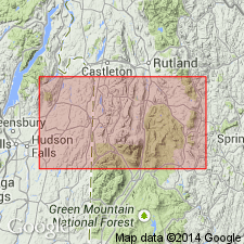
Pg. 210, 225. Gassetts schist. Silvery white, highly garnetiferous, muscovite schist; scaly texture, or muscovite is arranged in parallel plates and is by far the most abundant constituent. Is a highly metamorphosed sediment, which in certain outcrops has been affected by intrusives bearing boron and fluorine. Is a new and the oldest member of Upper Cambrian Missisquoi group. Underlies the typical sericite schists and quartzites of that group, of which it is the lower member. Overlies Bethel and Cavendish schists. Outcrops at Gassetts [Ludlow quadrangle] in northern part of Chester [Township], and at other places [mentioned] in Reading, Cavendish, Baltimore, and Chester Twps., Windsor County, southeastern Vermont. Assigned to Upper Cambrian.
[See also C.H. Richardson, 1931 (17th Rpt. Vermont State Geol., p. 198, 223). Also 18th Rpt. Vermont State Geol., where Richardson and J.E. Maynard state type locality is just north of Gassetts RR station.]
Source: US geologic names lexicon (USGS Bull. 896, p. 806).
- Usage in publication:
-
- Gassetts Schist Member
- Modifications:
-
- Revised
- AAPG geologic province:
-
- New England province
Summary:
Revised the Gassetts to the Gassetts Schist Member of the Cavendish Formation in central VT. Unit is of early Paleozoic age.
Source: GNU records (USGS DDS-6; Reston GNULEX).
- Usage in publication:
-
- Gassetts Schist Member*
- Modifications:
-
- Age modified
- AAPG geologic province:
-
- New England province
Summary:
The Gassetts Schist Member of the reinstated Cavendish Formation (Mount Holly Complex) consists of yellowish-green to gray-green rusty weathering, lustrous, large-garnet, chlorite-biotite-muscovite-quartz-plagioclase schist. Because the Cavendish Formation is correlated with the Wilcox Formation of Middle Proterozoic Mount Holly Complex, the age of the Gassetts is changed to Middle Proterozoic.
Source: GNU records (USGS DDS-6; Reston GNULEX).
For more information, please contact Nancy Stamm, Geologic Names Committee Secretary.
Asterisk (*) indicates published by U.S. Geological Survey authors.
"No current usage" (†) implies that a name has been abandoned or has fallen into disuse. Former usage and, if known, replacement name given in parentheses ( ).
Slash (/) indicates name conflicts with nomenclatural guidelines (CSN, 1933; ACSN, 1961, 1970; NACSN, 1983, 2005, 2021). May be explained within brackets ([ ]).