

- Usage in publication:
-
- Dolly Ridge Formation
- Modifications:
-
- Named
- Dominant lithology:
-
- Limestone
- Claystone
- Shale
- Bentonite
- AAPG geologic province:
-
- Appalachian basin
Summary:
Named Dolly Ridge Formation for brown and gray limestone interbedded with claystone, shale, and bentonite. Unit is 120 meters thick at its type locality on southeast side Dolly Ridge, Pendleton Co., WV. The Dolly Ridge overlies the Nealmont Limestone and underlies the Reedsville Shale. Age is considered Middle Ordovician.
Source: GNU records (USGS DDS-6; Reston GNULEX).
- Usage in publication:
-
- Dolly Ridge Formation
- Modifications:
-
- Overview
- AAPG geologic province:
-
- Appalachian basin
Summary:
Although the Trenton ("Martinsburg") Formation terminology is used in this report for strata overlying the Eggleston and Bays Formations, author would prefer a more suitable name such as Dolly Ridge Formation of Trenton Group (Perry, 1972) in this region. [Author does not explain why he uses Trenton ("Martinsburg") Formation if he prefers other nomenclature.]
Source: GNU records (USGS DDS-6; Reston GNULEX).
- Usage in publication:
-
- Dolly Ridge Formation*
- Modifications:
-
- Age modified
- AAPG geologic province:
-
- Appalachian basin
Summary:
In section C-C' the Dolly Ridge Formation of WV is of late Shermanian age based on its correlation with the Antes Shale of PA and OH. [This refutes the Edenian age assigned by Ryder (1992, USGS Misc. Inv. Series Map, I-2264; 1992, USGS Bull.1839-G, p. G1-G25).]
Source: GNU records (USGS DDS-6; Reston GNULEX).
- Usage in publication:
-
- Dolly Ridge Formation*
- Modifications:
-
- Age modified
- Overview
- AAPG geologic province:
-
- Appalachian basin
Summary:
In WV, Trenton Group consists of the Nealmont Limestone and the Dolly Ridge Formation. The Dolly Ridge Formation is assigned a Late Ordovician age because it correlates with the Antes Shale as revised by Sweet and Bergstrom (1976). [This age assignment subsequently refuted by Ryder and others, 1992, USGS Bull.1839-K, p. K1-K32.]
Source: GNU records (USGS DDS-6; Reston GNULEX).
- Usage in publication:
-
- Dolly Ridge Formation*
- Modifications:
-
- Areal extent
- AAPG geologic province:
-
- Appalachian basin
Summary:
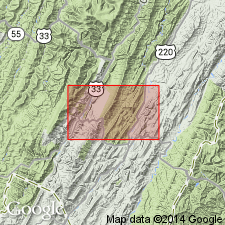
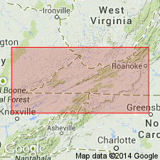
In cross section E-E', Dolly Ridge Formation used in the subsurface of Virginia and West Virginia for dark-gray to black shale and argillaceous limestone. Usage is restricted to the region near the Allegheny structural front. Shown as part of the Trenton Group. Age given as Late Ordovician (Edenian). Correlates with Antes Shale in WV and Utica Shale in OH.
Source: GNU records (USGS DDS-6; Reston GNULEX).
For more information, please contact Nancy Stamm, Geologic Names Committee Secretary.
Asterisk (*) indicates published by U.S. Geological Survey authors.
"No current usage" (†) implies that a name has been abandoned or has fallen into disuse. Former usage and, if known, replacement name given in parentheses ( ).
Slash (/) indicates name conflicts with nomenclatural guidelines (CSN, 1933; ACSN, 1961, 1970; NACSN, 1983, 2005, 2021). May be explained within brackets ([ ]).