The National Geologic Map Database is migrating to a new infrastructure. We apologize for any service disruptions during this process.
|
|---|


- Usage in publication:
-
- Dedham Granite*
- Modifications:
-
- Overview
- AAPG geologic province:
-
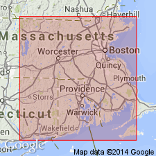
- New England province
Summary:
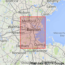
Used as Dedham Granite of Proterozoic Z age. Consists of light-grayish-pink to greenish-gray, equigranular to slightly porphyritic, variably altered granite south and west of Boston. Includes dioritic rock near Scituate and Cohasset. Includes rocks mapped as Barefoot Hills Quartz Monzonite of Lyons (1969) and Lyons and Wolfe (1971). Intrudes Proterozoic Z unnamed diorite, gabbro, Blackstone Group (undivided), and metamorphosed mafic to felsic flow and volcanic and hypabyssal intrusive rocks. Separately mapped as an informal part of the Dedham is gray granite to granodiorite that is more mafic than the main body and occurs north of Boston. It intrudes Westboro Formation and metamorphosed mafic to felsic flow and volcanic and hypabyssal intrusive rocks.
Source: GNU records (USGS DDS-6; Reston GNULEX).
- Usage in publication:
-
- Dedham Plutonic Suite
- Modifications:
-
- Revised
- Overview
- AAPG geologic province:
-
- New England province
Summary:
Geochemical data demonstrate that the Lynn and Mattapan Volcanic Complexes are compositionally similar and that they both overlap rocks of the Dedham Plutonic Suite. The Dedham appears to represent a calc-alkaline igneous suite formed at a plate margin. Shown on geologic map as occurring in MA and southeastern RI.
Source: GNU records (USGS DDS-6; Reston GNULEX).
- Usage in publication:
-
- Dedham Granite
- Modifications:
-
- Areal extent
- Geochronologic dating
- AAPG geologic province:
-
- New England province
Summary:
Westwood Granite intrudes the High Rock and Twin Pine Tuffs (new names) of Mattapan Volcanic Complex in Needham, Westwood, and the east side of the Stony Brook Reservation. Intrusion near Stony Brook Reservation previously mapped by Zen and others (1983) as Dedham Granite. Westwood was dated by Zartman and Naylor (1984) at 579+/-23 Ma and Mattapan was dated at 603+/-3 Ma by Kaye and Zartman (1980). Dedham, on the other hand, at 630+/-15 Ma is older than the Mattapan and could not be intrusive.
Source: GNU records (USGS DDS-6; Reston GNULEX).
- Usage in publication:
-
- Dedham Granite*
- Modifications:
-
- Overview
- Geochronologic dating
- AAPG geologic province:
-
- New England province
Summary:
Proterozoic Z Dedham Granite occupies large area within Milford-Dedham zone. Part of Dedham batholith. Intrudes Proterozoic Z rocks of Blackstone Group, Westboro Formation, and of the mafic volcanic-plutonic complex. Described as typically salmon colored, mottled by green clots of epidote and chlorite formed from alteration, medium to coarse grained, and commonly fractured. Fresh rocks that do not contain closely spaced joints are gray. Modal analysis and ternary plots indicate composition ranges mostly from granite to granodiorite, with a few samples identified as quartz monzodiorite or monzonite. As mapped on MA State Geologic Map (Zen and others, 1983), contains rocks previously assigned to Barefoot Hill quartz monzonite of Lyons (1969) in area north of Mansfield, MA, because it is in gradational contact with Dedham in the Brockton, MA area; these rocks are designated as a porphyritic variety of Dedham. Also as mapped on State Map, Dedham may include smaller bodies of younger granite, such as Westwood Granite, whose boundaries are not determined. Rock mapped as Westwood by Chute (1965) is believed to be a phase of Dedham. Proterozoic Z age of Dedham is based on the following isotopic dates: . 1. 630 +/-15 Ma by U/Pb methods on zircon (Zartman and Naylor, 1984) from Dedham Granite. 2. 595 +/-17 Ma by Rb/Sr whole rock methods (Kovach and others, 1977) from Dedham Granite north of Boston. 3. 640 +/-14 Ma by K-Ar methods on hornblende (Zartman and Naylor, 1984). Report includes geologic maps. [Papers presented as chapters in U.S. Geological Survey Professional Paper 1366 are intended as explanations and (or) revisions to MA State bedrock geologic map of Zen and others (1983) at scale of 1:250,000.]
Source: GNU records (USGS DDS-6; Reston GNULEX).
- Usage in publication:
-
- Dedham granodiorite, granite
- Modifications:
-
- Geochronologic dating
- Overview
- AAPG geologic province:
-
- New England province
Summary:
Extensive calc-alkaline plutons separated by Boston basin have long been mapped as Dedham. Those to the north of Boston and studied in this report, are referred to as Dedham North. Crystallization ages for the Dedham North suite (based on titanites and zircons) have been determined at 607+/-4 Ma, while ages for the Lynn are slightly younger at 596+/-3 Ma. Both are clearly part of the Late Proterozoic magmatic event. Dates on two samples from Sheffield Heights indicate that the diorite and granite are part of the Dedham North suite. The Dedham south and west of Boston has been dated at 630+/15 Ma (Zartman and Naylor, 1984). Dedham North Granite has a compositionally highly variable suite ranging from leucogranites to granodiorites, tonalites, and quartz diorite. The granites originated by partial melting of a sedimentary protolith, while the intermediate members show a mixing of granitic magma and mafic magma.
Source: GNU records (USGS DDS-6; Reston GNULEX).
For more information, please contact Nancy Stamm, Geologic Names Committee Secretary.
Asterisk (*) indicates published by U.S. Geological Survey authors.
"No current usage" (†) implies that a name has been abandoned or has fallen into disuse. Former usage and, if known, replacement name given in parentheses ( ).
Slash (/) indicates name conflicts with nomenclatural guidelines (CSN, 1933; ACSN, 1961, 1970; NACSN, 1983, 2005, 2021). May be explained within brackets ([ ]).