

- Usage in publication:
-
- Devilwater silt
- Modifications:
-
- Original reference
- AAPG geologic province:
-
- San Joaquin basin
Summary:
Pg. 67. Devilwater silt shown on composite columnar section of Wasco oil field. Overlies Gould shale; underlies McDonald shale. Age is middle Miocene.
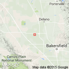
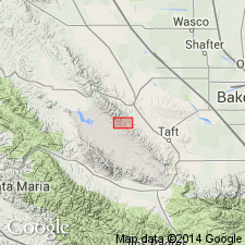
(Subsurface): depth-interval 11,300 to 11,500 ft, Wasco oil field, Kern Co., central CA.
Source: US geologic names lexicon (USGS Bull. 1200, p. 1107).
- Usage in publication:
-
- /Devilwater-Gould member
- Modifications:
-
- Revised
- AAPG geologic province:
-
- San Joaquin basin
Summary:
Pg. 1611 (fig. 2), 1616. [/]Devilwater-Gould member of Monterey shale. In southern part of Temblor, Monterey shale can be subdivided into three lithologic and faunal units, lowest of which is Devilwater-Gould member. At type area of Temblor formation, in vicinity of Chico Martinez Creek, the Devilwater silt, Gould shale, and "Buttonbed" sandstone lens are distinct faunal and lithologic units characterized, respectively, by the VALVULINERIA CALIFORNICA, VALVULINERIA ROBUSTA, and "SCUTELLA" MERRIAMI faunal zones. Recruit Pass area [this report], an interval of 1,850 feet of well-bedded siliceous light-brown shale, with minor amount of interbedded tan silt and lentils of massive buff limestone, comprise a single lithologic unit from which have been collected faunules common to both Gould shale and Devilwater silt as they are defined on Chico Martinez Creek. This unit is referred to as Devilwater-Gould member of Monterey. Underlies McDonald shale; overlies [/]Temblor-Vaqueros. Age is middle Miocene.
[The use of a hyphen between undifferentiated [members] is not considered proper notation (CSN, 1933).]
Source: US geologic names lexicon (USGS Bull. 1200, p. 1107).
- Usage in publication:
-
- Dewdney Creek formation
- Modifications:
-
- Revised
- AAPG geologic province:
-
- Northern Cascade Range-Okanagan province
Summary:
Pg. 5 (table 2). Termed a formation; geographically extended into northeastern Washington.
Source: US geologic names lexicon (USGS Bull. 1200, p. 1108).
- Usage in publication:
-
- Devilwater silt member
- Modifications:
-
- Areal extent
- AAPG geologic province:
-
- San Joaquin basin
Summary:
Road log, topographic profile, chart, map. Devilwater silt member of Monterey formation. Devilwater silt member underlies McDonald shale member and overlies Gould shale member in Chico Martinez Creek area, [Kern County, south-central California]. Thickness about 1,180 feet. Age is middle Miocene.
Source: US geologic names lexicon (USGS Bull. 1200, p. 1107).
- Usage in publication:
-
- Dewdney Creek group
- Modifications:
-
- Revised
- AAPG geologic province:
-
- Northern Cascade Range-Okanagan province
Summary:
Pg. 1534, chart 10e (column 58). Formation was listed by McKee and others (1956) as partly of Jurassic age. In Princeton area of British Columbia (Rice, 1947, Canada Geol. Survey Mem. 243), the upper 7,200 feet of Dewdney Creek group contains fossils definitely of Early Cretaceous age. [Report includes correlation chart.]
Source: US geologic names lexicon (USGS Bull. 1200, p. 1108).
For more information, please contact Nancy Stamm, Geologic Names Committee Secretary.
Asterisk (*) indicates published by U.S. Geological Survey authors.
"No current usage" (†) implies that a name has been abandoned or has fallen into disuse. Former usage and, if known, replacement name given in parentheses ( ).
Slash (/) indicates name conflicts with nomenclatural guidelines (CSN, 1933; ACSN, 1961, 1970; NACSN, 1983, 2005, 2021). May be explained within brackets ([ ]).