

- Usage in publication:
-
- Antes shale
- Modifications:
-
- Original reference
- AAPG geologic province:
-
- Appalachian basin
Summary:
Pg. 3 (fig. 2); Kay, 1944, Jour. Geol., v. 52, no. 2, p. 114. Antes shale of Trenton group. Comprises about 400 feet of dark, brownish-weathering shale lying between Coburn limestone and silty and arenaceous Reedsville shale. DICRANOGRAPTUS NICHOLSONI (Hall) abundant near top of formation; TIARTHRUS EATONI Hall common in underlying shales. Antes has been included in Reedsville in previous reports and maps of region. Age is Middle Ordovician (Mohawkian).
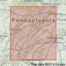
Notable exposures along Antes Creek above Antes Gap, Clinton Co., central PA.
Source: US geologic names lexicon (USGS Bull. 1200, p. 109).
- Usage in publication:
-
- Antes Shale
- Modifications:
-
- Age modified
- AAPG geologic province:
-
- Appalachian basin
Summary:
Fig. 3. Antes Shale. Age is changed to Late Ordovician (Edenian).
Source: Modified from GNU records (USGS DDS-6; Reston GNULEX).
- Usage in publication:
-
- Antes Formation*
- Modifications:
-
- Mapped
- Dominant lithology:
-
- Shale
- Limestone
- AAPG geologic province:
-
- Appalachian basin
Summary:
Pg. 10, pl. 1 (geol. map). Antes Formation. Dark-gray to black, fissile, calcareous shales. Some interbeds of medium-gray, medium-bedded, fine-grained limestones and sparingly fossiliferous, dark-gray, medium- to thick-bedded, coarse-grained limestones. Thickness 330 feet (100 m). Forms rolling valleys of low to moderate relief. Underlies Reedsville Formation, contact placed within 10 foot-interval of change from black calcareous shale to olive-gray noncalcareous silty shale. Gradationally overlies Coburn Formation; contact placed within an approximate 50 foot-interval of limestones interbedded with black calcareous shales. Fossils (crinoids, brachiopods). Age is Late Ordovician. [Adopted by the USGS.]
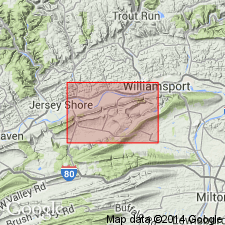
Type section stated to be on east bank of Antes Creek in immediate vicinity of U.S. Route 44 and PA Route 880 intersection in northwest part of Nippenose Valley, [north of Rauchtown, approx. Lat. 41 deg. 09 min. 48 sec. N., Long. 77 deg. 13 min. 12 sec. W., Linden 7.5-min quadrangle, Lycoming Co., north-central PA].
Source: Publication.
- Usage in publication:
-
- Antes Formation
- Modifications:
-
- Areal extent
- AAPG geologic province:
-
- Appalachian basin
Summary:
Antes Shale. Primarily dark-gray to black calcareous shale which weathers to pale yellowish-brown. Homogeneous and very thick bedded with moderate to excellent fissility. Contains a few thin interbeds of calcisiltite in middle and lower parts. Assumed to conformably overlie Coburn Formation. Gradationally underlies Reedsville Formation. Thickness 75 +/-10 m, calculated from dip and map-pattern width. Age is Late Ordovician.
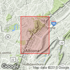
Best exposure in study area is in creek bed just south of the high-voltage power line on the west side of Sinking Valley. Recognized throughout northwestern part of the Valley and Ridge province in central Pennsylvania and in subsurface of the Appalachian plateau, western Pennsylvania.
Source: Modified from GNU records (USGS DDS-6; Reston GNULEX).
- Usage in publication:
-
- Antes Shale*
- Modifications:
-
- Age modified
- AAPG geologic province:
-
- Appalachian basin
Summary:
Pg. 25, pl. 1 (cross section and corr. chart). Antes Shale of Trenton Group. Is top formation of Trenton Group, following classification of Kay (1944a,b) and Thompson (Pennsylvania Geol. Survey Bull. G-38, 1963). Gradationally overlies Coburn Limestone of Trenton Group. Is equivalent to Dolly Ridge Formation of eastern West Virginia, and Utica Shale of Ohio. Age is changed from early Late Ordovician (early Edenian) --to-- late Middle Ordovician (late Shermanian) in most of study area, based on stratigraphic relations. No conodonts were recovered from the Antes. In central Pennsylvania, top of underlying Coburn Limestone yielded zonal index conodont AMORPHOGNATHUS TVAERENSIS (K.W. Valek, 1982, Ohio State Univ. unpub. MS thesis) indicating the Coburn is no younger than middle Shermanian [see W.C. Sweet, 1984, Paleo. Contrib. Univ. Oslo, no. 295, p. 25, fig. 2]. Given the gradational nature of the Coburn-Antes contact, the Antes Shale very likely is late Shermanian. This refutes the early Edenian age assigned to the Antes by Sweet and Bergstrom, 1976 (Paleo. Assoc. Symp. Proc., Ordovician System, Univ. Wales Press, p. 121-151) in central Pennsylvania, and by Ryder, 1991 (USGS Misc. Inv. Map I-2264) and 1992 (USGS Bull. 1839-G) in northern West Virginia. However, in segment of Rome trough (Somerset County, southern Pennsylvania) where the Antes Shale is thicker and occupies a higher stratigraphic position, age is considered late Middle to earliest Late Ordovician (late Shermanian to earliest Edenian), thus the Middle and Late Ordovician age assigned by Ryder (1991, 1992) to Trenton Group of Kay (1944a,b) is still valid due to probable Edenian age of upper part of Antes Shale in localities such as in the Rome trough.
Source: Publication.
- Usage in publication:
-
- Antes Shale*
- Modifications:
-
- Areal extent
- Age modified
- AAPG geologic province:
-
- Appalachian basin
Summary:
Antes Shale of Trenton Group. Extended from Pennsyvlania into subsurface of central West Virginia in cross section E-E' as upper part of Trenton Group. Correlates with Dolly Ridge Formation of eastern West Virginia and Utica Shale of Waverly arch area in Ohio. Age is Late Ordovician (Edenian) based on fossils. [This age assignment subsequently refuted by Ryder and others, 1992, USGS Bull. 1839-K, p. K1-K32.]
Source: Modified from GNU records (USGS DDS-6; Reston GNULEX).
For more information, please contact Nancy Stamm, Geologic Names Committee Secretary.
Asterisk (*) indicates published by U.S. Geological Survey authors.
"No current usage" (†) implies that a name has been abandoned or has fallen into disuse. Former usage and, if known, replacement name given in parentheses ( ).
Slash (/) indicates name conflicts with nomenclatural guidelines (CSN, 1933; ACSN, 1961, 1970; NACSN, 1983, 2005, 2021). May be explained within brackets ([ ]).