- Usage in publication:
-
- Cooleyville Granitic Gneiss
- Modifications:
-
- Original reference
- Dominant lithology:
-
- Gneiss
- AAPG geologic province:
-
- New England province
Robinson, Peter, 1967, Progress report on bedrock geologic mapping in west-central Massachusetts: University of Massachusetts, Conference on Economic Geology in Massachusetts Proceedings, p. 29-47.
Summary:
Pg. 34, 41. Cooleyville Granitic Gneiss. A part of the Prescott Intrusive Complex. Age is Devonian(?).
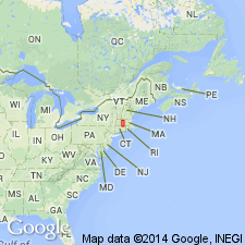
Prescott Intrusive Complex is in Bronson Hill anticline, [west-central Massachusetts], a complex zone of gneiss domes and recumbent folds that lies near center of Appalachian tectonic belt of New England.
Source: US geologic names lexicon (USGS Bull. 1350, p. 169).

- Usage in publication:
-
- Cooleyville Granitic Gneiss*
- Modifications:
-
- Age modified
- AAPG geologic province:
-
- New England province
Summary:
Used as Cooleyville Granitic Gneiss of Prescott Complex. Age is Devonian. [No explanation given for assignment to Prescott Complex or change in age.]
Source: GNU records (USGS DDS-6; Reston GNULEX).

- Usage in publication:
-
- Cooleyville Granitic Gneiss*
- Modifications:
-
- Revised
- Geochronologic dating
- Age modified
- AAPG geologic province:
-
- New England province
Summary:
Cooleyville Granitic Gneiss assigned to implicitly reinstated and revised Prescott Complex. Applied to extensive exposures of fine- to coarse-grained gneissic biotite tonalite, granodiorite, and granite that surround hornblende gabbro of Prescott Complex on Prescott Peninsula of Quabbin Reservoir. Intrudes Lower Devonian Littleton Formation and contains extensive inclusions of hornblende gabbro of Prescott Complex. Foliation and lineation are congruent and are identical to those found in adjacent gneiss domes that formed during Acadian Orogeny. Preliminary Rb-Sr whole-rock isochron (citing Naylor, 1970), based in part on deformed aplite dikes within the Cooleyville, suggests a minimum age of 385 Ma. (Devonian).
Typical exposures occur in hills 0.8 to 3.2 km northeast, east, and southeast of Cooleyville. Unit is named for village of Cooleyville, western edge of Town of New Salem, Franklin Co., MA.
Source: GNU records (USGS DDS-6; Reston GNULEX).
For more information, please contact Nancy Stamm, Geologic Names Committee Secretary.
Asterisk (*) indicates published by U.S. Geological Survey authors.
"No current usage" (†) implies that a name has been abandoned or has fallen into disuse. Former usage and, if known, replacement name given in parentheses ( ).
Slash (/) indicates name conflicts with nomenclatural guidelines (CSN, 1933; ACSN, 1961, 1970; NACSN, 1983, 2005, 2021). May be explained within brackets ([ ]).

