

- Usage in publication:
-
- Conasauga shale*
- Modifications:
-
- Named
- Dominant lithology:
-
- Shale
- Limestone
- AAPG geologic province:
-
- Appalachian basin
Summary:
Named the Conasauga shale for the Conasauga Valley, northwestern GA. Consists of (ascending) (1) purple, green, and brown, variegated sandy shales, (2) oolitic limestone with thin beds of light green or yellow shales, (3) yellow shales, (4) earthy limestone interbedded with shales and containing chert nodules, (5) yellow calcareous shales grading downward into seamy limestone, (6) thin-bedded seamy limestone, sometimes blue and massive. Thickness is 1600 to 2000 feet. Overlies Rome sandstone. The Conasauga is of Middle and Late Cambrian age.
Source: GNU records (USGS DDS-6; Reston GNULEX).
- Usage in publication:
-
- Conasauga shale, group
- Modifications:
-
- Revised
- AAPG geologic province:
-
- Appalachian basin
Summary:
In eastern TN the Conasauga varies in lithology and three phases are recognized: northwestern phase largely of shale, central phase of alternating shale and limestone formations, and southeastern phase principally of dolomite but including some limestone and shale. In northwestern phase, Conasauga shale includes Pumpkin Valley shale member below and Maynardville limestone member above. In central phase (between Knoxville and Morristown, and north of Clinch Mountain), Conasauga group consists of six formations (ascending): Pumpkin Valley shale, Rutledge limestone, Rogersville shale, Maryville limestone, Nolichucky shale, and Maynardville limestone. Southeast boundary of central phase is marked by disappearance of Rogersville shale and merging of Maryville and Rutledge formations, here largely dolomite, into Honaker dolomite. In southeastern phase, sequence is (ascending) Honaker dolomite, Nolichucky shale, and Maynardville limestone. To the northeast, in VA, the shale units thin to disappearance until whole is carbonate rock with some shaly dolomite beds (Elbrook dolomite). Overlies Rome formation and underlies Copper Ridge dolomite and to southeast the Conococheague limestone.
Source: GNU records (USGS DDS-6; Reston GNULEX).
- Usage in publication:
-
- Conasauga shale*
- Modifications:
-
- Areal extent
- AAPG geologic province:
-
- Appalachian basin
Summary:
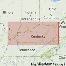
Geographically extended the Conasauga shale to southwestern VA. Name is used in place of Nolichucky shale. Only upper half of Conasauga is exposed in Lee Co. area. Underlies the Low Hollow limestone member of the Maynardville limestone.
Source: GNU records (USGS DDS-6; Reston GNULEX).
- Usage in publication:
-
- Conasauga group
- Modifications:
-
- Overview
- AAPG geologic province:
-
- Appalachian basin
Summary:
The Conasauga group in VA includes the Nolichucky formation, Maynardville formation, Elbrook formation, Honaker dolomite, Pumpkin Valley shale, Rutledge limestone, Rogersville shale, and Maryville limestone.
Source: GNU records (USGS DDS-6; Reston GNULEX).
- Usage in publication:
-
- Conasauga Shale*
- Modifications:
-
- Areal extent
- AAPG geologic province:
-
- Appalachian basin
Summary:
Geographically extended the Conasauga Shale to the subsurface of KY. Stratigraphic column (figure 2) shows Conasauga Shale overlying the Rome Formation and underlying the Maynardville Limestone. Unit is of Middle and Late Cambrian age.
Source: GNU records (USGS DDS-6; Reston GNULEX).
- Usage in publication:
-
- Conasauga Group
- Modifications:
-
- Overview
- AAPG geologic province:
-
- Appalachian basin
Summary:
The Conasauga Group in northeastern TN includes (ascending) the Pumpkin Valley Shale, Rutledge Limestone, Rogersville Shale, Maryville Limestone, Nolichucky Shale, Maynardville Formation, and Copper Ridge Dolomite. Middle-Upper Cambrian boundary is shown to lie at the contact between the Maryville and Nolichucky. Thickness of Conasauga Group is 3225 feet. Overlies the Rome Formation and underlies the Knox Group.
Source: GNU records (USGS DDS-6; Reston GNULEX).
- Usage in publication:
-
- Conasauga Group
- Modifications:
-
- Overview
- AAPG geologic province:
-
- Appalachian basin
Summary:
The Conasauga Group attains a maximum of 885 meters thick in northeast TN and southwest VA. Northwest of Warren Valley fault it includes only the Maynardville Limestone (top) and undivided shale. Between Warren Valley fault and Pulaski fault unit includes the (ascending) Pumpkin Valley Shale, Rutledge Limestone, Rogersville Shale, Maryville Limestone, Nolichucky Shale, and Maynardville Limestone. Southeast of the Pulaski fault it includes the Honaker Dolomite, Nolichucky Shale, and Maynardville Limestone.
Source: GNU records (USGS DDS-6; Reston GNULEX).

- Usage in publication:
-
- Conasauga Group*
- Modifications:
-
- Revised
- AAPG geologic province:
-
- Appalachian basin
Summary:
The use of Conasauga Group is extended to the Rome-Kingston thrust stack in GA and AL where it includes, in ascending order, the Honaker Dolomite, Rogersville Shale, Maryville Limestone, Nolichucky Shale, and Maynardville Limestone. Age is Middle and Late Cambrian.
Source: GNU records (USGS DDS-6; Reston GNULEX).

- Usage in publication:
-
- Conasauga Formation
- Modifications:
-
- Overview
- AAPG geologic province:
-
- Appalachian basin
Summary:
The Conasauga Formation in northern AL is present in the subsurface of the Plateaus and crops out in the Valley and Ridge province. Thickness ranges from 500 feet in Talladega Co., to about 2600 feet in the Valley and Ridge. Overlies the Rome Formation and underlies the Ketona Dolomite or Brierfield Dolomite.
Source: GNU records (USGS DDS-6; Reston GNULEX).
- Usage in publication:
-
- Conasauga Limestone
- Modifications:
-
- Areal extent
- AAPG geologic province:
-
- Warrior basin
Summary:
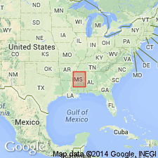
Geographically extended the Conasauga Limestone into the subsurface of the Warrior basin in MS. Thickness is 0 to 1187 feet. Overlies the Rome Formation and underlies the Copper Ridge Dolostone of the Knox Group. The Conasauga is of Middle and Late Cambrian age.
Source: GNU records (USGS DDS-6; Reston GNULEX).
- Usage in publication:
-
- Conasauga Group*
- Modifications:
-
- Revised
- Areal extent
- AAPG geologic province:
-
- Appalachian basin
Summary:
In cross section E-E', in subsurface of Rome trough, WV, Conasauga Group used for thick sequence of shale, carbonate and siltstone. Areally extended into WV. Includes four of its six formations in ascending order: Pumpkin Valley Shale, Rutledge Limestone, Rogersville Shale, and Maryville Limestone. Lower limestone unit previously assigned to Conasauga by Webb (1980) and Donaldson and others (1988) is here assigned to Rome Formation; more consistent with outcrop data in eastern TN. Conasauga probably intertongues westward with Rome. Uppermost beds become Mount Simon Sandstone west of Ohio-West Virginia hinge zone in OH. Unnamed dolomite member of Maryville correlates with dolomite of Rome to the west; to the east, dolomite becomes upper part of Elbrook Dolomite. Age is Middle and Late Cambrian based on fossils.
Source: GNU records (USGS DDS-6; Reston GNULEX).
- Usage in publication:
-
- Conasauga Group
- Modifications:
-
- Age modified
- AAPG geologic province:
-
- Appalachian basin
Summary:
Age of the Conasauga Group is Middle Cambrian in WV and KY only.
Source: GNU records (USGS DDS-6; Reston GNULEX).

- Usage in publication:
-
- Conasauga Shale
- Modifications:
-
- Age modified
- Overview
- AAPG geologic province:
-
- Appalachian basin
Summary:
Conasauga Shale mapped in Roane Co., eastern TN. Unit consists of gray, red, light-green, and dull purple, argillaceous, and silty shale. Scattered throughout are zones of somewhat oolitic, shaly, gray limestone, as much as 100 ft thick. The formation is contorted, brecciated, and sheared. Thickness approximately 2,000 ft. Overlies Lower Cambrian Rome Formation and underlies Upper Cambrian Maynardville Limestone. Age is Middle Cambrian, only, in this report.
Source: GNU records (USGS DDS-6; Reston GNULEX).
- Usage in publication:
-
- Conasauga Formation, Group*
- Modifications:
-
- Overview
- AAPG geologic province:
-
- Appalachian basin
Summary:
The Conasauga occurs in the subsurface of KY as the Conasauga Formation in the Waverly arch and Ohio-West Virginia hinge zone, and as the Conasauga Group in the Rome trough as shown in section G-G'. The Conasauga Formation overlies the Mount Simon Sandstone and underlies the Copper Ridge Dolomite of the Knox Group. The Conasauga Group consists of the (ascending) Pumpkin Valley Shale, Rutledge Limestone, Rogersville Shale, Maryville Limestone, Nolichucky Shale, and Maynardville Limestone; it overlies the Rome Formation and underlies the Copper Ridge Dolomite. The Conasauga is of Middle and Late Cambrian age.
Source: GNU records (USGS DDS-6; Reston GNULEX).
For more information, please contact Nancy Stamm, Geologic Names Committee Secretary.
Asterisk (*) indicates published by U.S. Geological Survey authors.
"No current usage" (†) implies that a name has been abandoned or has fallen into disuse. Former usage and, if known, replacement name given in parentheses ( ).
Slash (/) indicates name conflicts with nomenclatural guidelines (CSN, 1933; ACSN, 1961, 1970; NACSN, 1983, 2005, 2021). May be explained within brackets ([ ]).