The National Geologic Map Database is migrating to a new infrastructure. We apologize for any service disruptions during this process.
|
|---|


- Usage in publication:
-
- Collinsville granite gneiss
- Modifications:
-
- Original reference
- Dominant lithology:
-
- Granite
- Gneiss
- AAPG geologic province:
-
- New England province
Summary:
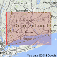
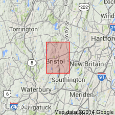
Pg. 105-107 and map. Collinsville granite gneiss. Two types appear intermingled without order: (1) light-gray, heavy-bedded, finely crystalline rock, grading into massive granite; and (2) a very dark gray to black variety which grades by imperceptible stages into even-banded hornblende gneiss and, rarely, into schistose stages. The darker varieties are produced by greater development of biotite in bands and patches, and the rock splits readily into even slabs from 1 inch to 10 inches thick. Dike and veins of fine-grained granite and coarser pegmatite occur in Collinsville granite gneiss. Hornblende and plagioclase are so abundant in parts of the Collinsville that the whole formation might be called a granodiorite gneiss. Well exposed at Collinsville, northern central Connecticut. Age is Ordovician(?).
Source: US geologic names lexicon (USGS Bull. 896, p. 490-491).
- Usage in publication:
-
- Collinsville granite gneiss
- Modifications:
-
- Overview
- AAPG geologic province:
-
- New England province
Summary:
Pg. 34. Collinsville granite gneiss. Was originally granite and diorite intruded into Hartland [Hoosac] schist.
Source: US geologic names lexicon (USGS Bull. 896, p. 490-491).

- Usage in publication:
-
- Collinsville Formation*
- Modifications:
-
- Overview
- AAPG geologic province:
-
- New England province
Summary:
Used as Collinsville Formation of Middle Ordovician or older age. Divided into nine informal mappable units based on lithology. [Bristol and Sweetheart Mountain Members not used.]
Source: GNU records (USGS DDS-6; Reston GNULEX).
- Usage in publication:
-
- Collinsville Formation*
- Modifications:
-
- Overview
- Areal extent
- AAPG geologic province:
-
- New England province
Summary:
Part of Bronson Hill anticlinorium, not part of Rowe-Hawley zone, but discussed in this report to emphasize importance of junction between Rowe-Hawley zone and Bronson Hill anticlinorium. Collinsville is exposed in Granville and Shelburne Falls domes, and to a limited extent in Goshen dome (Hatch and Warren, 1982). Consists of various light-colored, plagioclase-rich gneisses and interlayered amphibolite and hornblende gneiss. Upper part is amphibolite-rich; lower part is predominantly feldspathic gneiss. In places, thin aluminous feldspathic schist, locally containing coticule and amphibolite, forms an upper unnamed member of formation in Granville dome, or is Sweetheart Mountain Member of Stanley (1964) in Collinsville and Bristol domes in CT. Most complete sequence is in Shelburne Falls dome where L.M. Hall (1977, written commun.) has recognized seven mappable subdivisions. With minor modification, they are (ascending) 1) amphibolite with thin felsic gneiss layers; 2) rusty-weathering massive granulites; 3) very homogeneous garnetiferous biotite gneiss; 4) interlayered amphibolite and felsic gneiss; 5) felsic gneiss with scattered biotite +/-magnetite, garnet, and hornblende; 6) interbedded amphibolite and white felsic gneiss; and 7) gray, tan-weathering granulites containing thin coticule layers. Members 4, 5 and 6 are approximately equivalent to Ammonoosuc Volcanics. Member 3 is lithically similar to Monson and Fourmile Gneisses. Age in report is Ordovician. [Papers presented as chapters in U.S. Geological Survey Professional Paper 1366 are intended as explanations and (or) revisions to MA State bedrock geologic map of Zen and others (1983) at scale of 1:250,000.]
Source: GNU records (USGS DDS-6; Reston GNULEX).
- Usage in publication:
-
- Collinsville Formation*
- Modifications:
-
- Revised
- Dominant lithology:
-
- Gneiss
- Quartzite
- Schist
- AAPG geologic province:
-
- New England province
Summary:
Metamorphic strata in the report area that lie above the Bristol Gneiss (as it is here revised) and below The Straits Schist are assigned to the Collinsville Formation. Unit is divided into a lower unnamed hornblende gneiss member (was uppermost part of Stanley's (1964) Bristol Member) approximately 400 ft thick, an unnamed metaquartzite member that averages 100 ft, and the upper Sweetheart Mountain Member adopted here as defined by Stanley. Inferred age is Middle Ordovician. Correlates, at least in part, with the Hawley Formation of MA.
Source: GNU records (USGS DDS-6; Reston GNULEX).
For more information, please contact Nancy Stamm, Geologic Names Committee Secretary.
Asterisk (*) indicates published by U.S. Geological Survey authors.
"No current usage" (†) implies that a name has been abandoned or has fallen into disuse. Former usage and, if known, replacement name given in parentheses ( ).
Slash (/) indicates name conflicts with nomenclatural guidelines (CSN, 1933; ACSN, 1961, 1970; NACSN, 1983, 2005, 2021). May be explained within brackets ([ ]).