

- Usage in publication:
-
- Osgood Mountain quartzite*
- Modifications:
-
- Named
- Dominant lithology:
-
- Quartzite
- AAPG geologic province:
-
- Great Basin province
Summary:
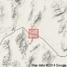
Named for Osgood Mountains [name should have been Osgood Mountains Quartzite] where type locality is, in NE/4 R40E T36N, Golconda 30' quad, Humboldt Co, NV. In Winnemuca 30' quad, lithology is white quartzite, somewhat micaceous, in upper part interbedded white quartz-mica schist. Unfossiliferous. Base not exposed. Underlies Preble Formation. In thrust contact with other Paleozoic formations. Thickness at type locality is 5,000 feet. Present in three limited outcrop areas on east flank of northern Sonoma Range. Assigned Early Cambrian(?) age based on stratigraphic relations.
Source: GNU records (USGS DDS-6; Menlo GNULEX).
- Usage in publication:
-
- Osgood Mountain quartzite*
- Modifications:
-
- Areal extent
- AAPG geologic province:
-
- Great Basin province
Summary:
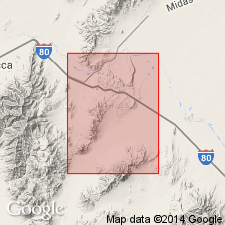
Geographically extended into report area: R40E T35N in northeast part of Sonoma Range and southwesternmost part (R40E T36N) Osgood Mountains. Outcrop area in Osgood Mountains, in Golconda 30' quad, is considered type locality. Massive, light-brown quartzite, generally fine-grained, locally cross-bedded. Micaceous partings along bedding planes; a few thin beds of siliceous brown slate. Proportion of mica increases upward, producing bands of quartz-mica schist. Conformably underlies Preble Formation. Base not exposed. Oldest of lower plate of Golconda thrust. Probably exceeds 5,000 feet thickness. Age considered Early Cambrian(?) based on probable correlation with other similar quartzites, in part possibly of Early Cambrian(?) age present throughout much of Nevada.
Source: GNU records (USGS DDS-6; Menlo GNULEX).
- Usage in publication:
-
- Osgood Mountain quartzite*
- Modifications:
-
- Overview
- AAPG geologic province:
-
- Great Basin province
Summary:
Is oldest unit of lower Paleozoic transitional assemblage in Osgood Mountains and adjacent areas. Shallow-marine quartzite; at least 5,000 feet thick. Grades upward into Preble Formation; basal contact is thrust fault. Assigned Early Cambrian(?) age based on stratigraphic relations.
Source: GNU records (USGS DDS-6; Menlo GNULEX).
- Usage in publication:
-
- Osgood Mountain quartzite*
- Modifications:
-
- Areal extent
- Revised
- AAPG geologic province:
-
- Great Basin province
Summary:
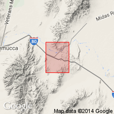
Geographically extended into central and south-central parts of the Osgood Mountains (extends southwestward for about 9 miles from latitude of Goughs Canyon and Hogshead Canyon to southwesternmost part of range in northern part of Galconda quadrangle). Lithology is predominantly white, gray, pale-greenish-gray, pale brown, and purplish-brown, medium- to thick-bedded quartzite. Commonly massive with obscure bedding. Cross-bedding characteristic of quartzite in many exposures. Unfossiliferous. At least 5,000 feet thick. Gradational into overlying Preble Formation. Base not exposed. Locally includes Twin Canyon Member [at top]. Assigned Early Cambrian(?) age based on stratigraphic relations.
Source: GNU records (USGS DDS-6; Menlo GNULEX).
- Usage in publication:
-
- Osgood Mountain Quartzite*
- Modifications:
-
- Areal extent
- AAPG geologic province:
-
- Great Basin province
Summary:
Mapped only in north-central part of Golconda quadrangle just north of Emigrant Canyon in southwesternmost part of Osgood Mountains. Thickness not stated. Gradationally overlain by Preble Formation; base not exposed. Assigned Cambrian age. [No evidence given for unqueried Cambrian age.]
Source: GNU records (USGS DDS-6; Menlo GNULEX).
- Usage in publication:
-
- Osgood Mountain Quartzite*
- Modifications:
-
- Areal extent
- AAPG geologic province:
-
- Great Basin province
Summary:
Geographically extended into north end (no exact lithology stated) of Edna Mountain, Humboldt County. Underlies Preble Formation; underlying(?) unit not given. Thickness not stated. Assigned Cambrian(?) age.
Source: GNU records (USGS DDS-6; Menlo GNULEX).
- Usage in publication:
-
- Osgood Mountain Quartzite*
- Modifications:
-
- Areal extent
- AAPG geologic province:
-
- Great Basin province
Summary:
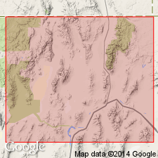
Mapped on east flank of northern part of Sonoma Range (sec 5, 8, 9, 17, 20, 21, 28, 29, T35N, R40E) and sec 32, T36N, R40E; southwesternmost part of Osgood Mountains (sec 13, 14, 23, and sec 26, T36N, R40E); and sec 2, T35N, R40E. Lithology is light brown weathering white to light-gray, thin- to massive-bedded, cross-bedded, relatively pure quartzite with thin, micaceous, silty partings. About 5,000 ft thick. Gradationally overlain by Preble Formation; base not exposed. Assigned Early Cambrian(?) age based on stratigraphic relations.
Source: GNU records (USGS DDS-6; Menlo GNULEX).
- Usage in publication:
-
- Osgood Mountain Quartzite*
- Modifications:
-
- Age modified
- AAPG geologic province:
-
- Great Basin province
Summary:
Age revised from Cambrian(?) to: Early Cambrian based on Stratigraphic relations --fossils (OLENELLUS, WANNERIA, BUNNIA) in the overlying Preble Formation.
Source: GNU records (USGS DDS-6; Menlo GNULEX).
For more information, please contact Nancy Stamm, Geologic Names Committee Secretary.
Asterisk (*) indicates published by U.S. Geological Survey authors.
"No current usage" (†) implies that a name has been abandoned or has fallen into disuse. Former usage and, if known, replacement name given in parentheses ( ).
Slash (/) indicates name conflicts with nomenclatural guidelines (CSN, 1933; ACSN, 1961, 1970; NACSN, 1983, 2005, 2021). May be explained within brackets ([ ]).