The National Geologic Map Database is migrating to a new infrastructure. We apologize for any service disruptions during this process.
|
|---|


- Usage in publication:
-
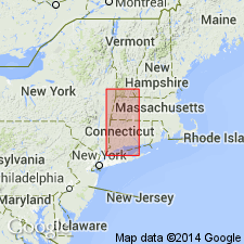
- Cobble Mountain Formation*
- Modifications:
-
- Named
- Dominant lithology:
-
- Schist
- Gneiss
- AAPG geologic province:
-
- New England province
Summary:
Named for Cobble Mountain Reservoir, Hampden Co., southwestern MA. Excellent exposures found around and near eastern shores of reservoir. Includes rocks previously mapped as unit 4Tb and 5, and upper 200 m of unit 4rm of Stanley (1967). Divided into a lower thin-bedded member and an upper thick-bedded member, each of which is divisible into mappable units. Thin-bedded member consists of red-rusty-weathering schist in its lower part and a more extensive thin-bedded granulite and schist in its upper part. Thickness at type area about 2000 m; southwest of Blandford village, formation is 600 m; about 4 km to the east, estimated at about 1000 m. Grades into underlying Moretown Formation; upper contact is marked by appearance of schist and quartzite of Goshen Formation. Is considered to be a facies equivalent of Hawley Formation. No fossils found in Cobble Mountain Formation. Age is Middle Ordovician based entirely on age of Hawley, which in turn relies on age of Missisquoi Formation (with which Hawley is partially correlative), which bases its age on fossils from Magog Formation (Canadian equivalent of Missisquoi). All formations are along strike through a deformed belt 350 km long.
Source: GNU records (USGS DDS-6; Reston GNULEX).

- Usage in publication:
-
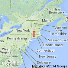
- Cobble Mountain Formation*
- Modifications:
-
- Overview
- AAPG geologic province:
-
- New England province
Summary:
Used as Cobble Mountain Formation of Middle Ordovician age. Subdivided into nine informal units based on lithologic differences.
Source: GNU records (USGS DDS-6; Reston GNULEX).
- Usage in publication:
-
- Cobble Mountain Formation*
- Modifications:
-
- Revised
- Overview
- AAPG geologic province:
-
- New England province
Summary:
Cobble Mountain Formation divided into four informal members (Knapp, 1977, 1978; Stanley and others, 1980), designated A to D, from bottom to top. Member A, which interfingers with Hawley Formation, and member B occupy largest areas on MA State Geologic Map while members C and D are restricted to west and north sides of Granville dome. Cobble Mountain rocks differ from Hawley rocks in that Cobble Mountain rocks are noncarbonaceous, distinctly bedded (with some grading), and generally coarser grained. Member A consists of granofels and minor intercalated amphibolite. Member B consists of silvery-gray feldspathic schist and gneiss. Member C consists of nonrusty-weathering feldspar rich schist; brown, rusty-weathering schist; and distinctive kyanite and sillimanite schist containing magnetite and porphyroblasts of plagioclase. Lower contact of member C is Winchell Mountain thrust. Member D is very thin and occurs between aforementioned members of Cobble Mountain Formation and Silurian and Devonian rocks of Russell Mountain and Goshen Formations; consists of dark-brown, fine- to medium-grained, thinly bedded schist and gneiss. Basal contact of member D is an unconformity. Age of Cobble Mountain Formation is Middle Ordovician based on facies relations of member A with Hawley Formation; however, assignment is speculative due to uncertainty of correlation of Hawley with fossiliferous black slates of Magog Group of Quebec. Member D could possibly be Silurian on basis of unconformity at base of member, although Middle Ordovician age is equally possible. [Papers presented as chapters in U.S. Geological Survey Professional Paper 1366 are intended as explanations and (or) revisions to MA State bedrock geologic map of Zen and others (1983) at scale of 1:250,000.]
Source: GNU records (USGS DDS-6; Reston GNULEX).
For more information, please contact Nancy Stamm, Geologic Names Committee Secretary.
Asterisk (*) indicates published by U.S. Geological Survey authors.
"No current usage" (†) implies that a name has been abandoned or has fallen into disuse. Former usage and, if known, replacement name given in parentheses ( ).
Slash (/) indicates name conflicts with nomenclatural guidelines (CSN, 1933; ACSN, 1961, 1970; NACSN, 1983, 2005, 2021). May be explained within brackets ([ ]).