

- Usage in publication:
-
- Sage Creek formation*
- Modifications:
-
- Principal reference
- Revised
- Dominant lithology:
-
- Sandstone
- Conglomerate
- AAPG geologic province:
-
- Montana folded belt
Summary:
This is one of the [first?] published reports to give a detailed description of the Sage Creek formation in the Sage Creek area. Consists of olive to yellow-gray, evenly bedded, tuffaceous sandstone with numerous lenses of coarser sandstone that grade into pebble conglomerate, and a few laminae of mudstone. The conglomerate is composed of quartzite cobbles and boulders of volcanics. Some beds are cross-laminated; some are cross-bedded. Lower contact with Paleocene(?) age Bearhead formation not exposed. Upper contact unconformable with an unnamed Tertiary conglomerate. Exposures of Sage Creek limited; no evidence found that Sage Creek either lenses out or is widespread. Sage Creek of Douglass (1903) and Wood (1931) is revised in this report to include: beds assigned to both the Sage Creek and Wood Ranch formations by Wood (1931); an additional 200 feet-thick buff sandstone at top that was not included by Douglass (1903). As revised, age of Sage Creek is late Eocene, Duchesnean(?) and Oligocene [implied on fig 2]. Vertebrate fauna, similar to fauna at Badwater Creek, Wyoming, is described from the lower part of Sage Creek, unconformably above a sandstone lens or above the Sage Creek formation of Wood (1931). Report includes comparison list of Sage Creek, Badwater, and Duchesne River faunas.
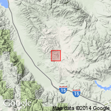
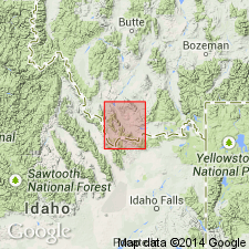
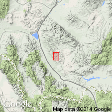
Type locality: in sec. 29, T. 12 S., R. 8 W., Beaverhead Co., MT [in the Montana folded belt province].
Source: Modified from GNU records (USGS DDS-6; Denver GNULEX).
- Usage in publication:
-
- Sage Creek formation
- Modifications:
-
- Overview
- Dominant lithology:
-
- Sandstone
- Conglomerate
- Clay
- Tuff
- Basalt
- AAPG geologic province:
-
- Montana folded belt
Summary:
Consists of basal basalt, sandstone, conglomerate, clay, and tuff. Type locality stated to be about 8 mi north of Lima, Beaverhead Co, MT. Is distributed over an area of about 4 sq mi between valley of Sage Creek and the Red Rock Mountains northeast of town of Dell, Montana folded belt province. Thickness uncertain; estimated at 300-400 ft; beds exposed at type are not more than 100 ft thick. Rests unconformably on Beaverhead formation. Basal badly weathered basalt--called "Sage Creek basalts"--occur at base of Sage Creek formation in T12S, R8W north of Sage Creek where the Sage Creek sediments are missing and the basalt is overlain by the middle Oligocene Cook Ranch formation. Fossil vertebrates listed. Eocene age. Stratigraphic chart. Geologic map. Stratigraphic table.
Source: GNU records (USGS DDS-6; Denver GNULEX).
- Usage in publication:
-
- Sage Creek Formation
- Modifications:
-
- Age modified
- AAPG geologic province:
-
- Montana folded belt
Summary:
Shown on a correlation chart as Bridgerian in age in the Sage Creek basin, southwest MT in the Montana folded belt province, and as unconformably above older rocks [name not shown] and as unconformably below "Hall Spring basalt" of Uintan age. Stated in appendix to be early Bridgerian (lower part) at Fields Draw [location not shown] and ?late Bridgerian (upper part) at its type.
Source: GNU records (USGS DDS-6; Denver GNULEX).
- Usage in publication:
-
- Sage Creek Formation*
- Modifications:
-
- Contact revised
- AAPG geologic province:
-
- Montana folded belt
Summary:
Lower contact revised in that Sage Creek Formation of late Eocene age unconformably overlies the newly named Red Butte Conglomerate, upper formation of the Beaverhead Group. Rocks now assigned to the Red Butte were called informally Red Butte conglomerate unit, McKnight conglomerate, Chute Canyon sandstone, or as an unnamed conglomerate in earlier reports. Red Butte has been mapped (geologic map) on both sides of Red Rock valley between Ashbough Canyon and Red Butte, near Dell, Beaverhead Co, MT in the Montana folded belt province. Of late Eocene age.
Source: GNU records (USGS DDS-6; Denver GNULEX).
For more information, please contact Nancy Stamm, Geologic Names Committee Secretary.
Asterisk (*) indicates published by U.S. Geological Survey authors.
"No current usage" (†) implies that a name has been abandoned or has fallen into disuse. Former usage and, if known, replacement name given in parentheses ( ).
Slash (/) indicates name conflicts with nomenclatural guidelines (CSN, 1933; ACSN, 1961, 1970; NACSN, 1983, 2005, 2021). May be explained within brackets ([ ]).