

- Usage in publication:
-
- Blackjack School sandstone member*
- Modifications:
-
- Original reference
- Dominant lithology:
-
- Sandstone
- AAPG geologic province:
-
- Chautauqua platform
Summary:
Pg. 503-520. Blackjack School sandstone member of Atoka formation. Thin to massive bedded sandstone, medium- to fine-grained, commonly greenish brown, weathering dirty yellowish brown, but sometimes white to light brown on fresh surfaces; grades downward into sandy shale. Fossils. Thickness 25 to 40 feet. Lies 150 to 220 feet below top of Atoka formation and 150 to 350 feet above Webbers Falls sandstone member. Age is Pennsylvanian.
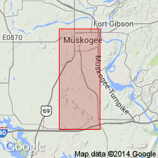
Named from exposures at and around Blackjack School, in sec. 9, T. 11 N., R. 19 E., [Muskogee Co.], eastern OK. Also recognized in McIntosh Co.
Source: US geologic names lexicon (USGS Bull. 896, p. 203); supplemental information from GNU records (USGS DDS-6; Denver GNULEX).
For more information, please contact Nancy Stamm, Geologic Names Committee Secretary.
Asterisk (*) indicates published by U.S. Geological Survey authors.
"No current usage" (†) implies that a name has been abandoned or has fallen into disuse. Former usage and, if known, replacement name given in parentheses ( ).
Slash (/) indicates name conflicts with nomenclatural guidelines (CSN, 1933; ACSN, 1961, 1970; NACSN, 1983, 2005, 2021). May be explained within brackets ([ ]).